Continuing the drive along the coastal road eastward toward the town of Vik and beyond.
All images are geotagged and hyperlinked to open full screen. To view them on a map, save the image to your hard drive and then download this FREE SOFTWARE. Install and click on the image in the left panel to view in a map as to the location where it was taken. (SAMPLE VIEW)

Dyrhólaey Lighthouse, Dyrhólaey, Vik, Iceland

Ocean View, Dyrhólaey, Vik, Iceland

Rock Bridge, Dyrhólaey, Vik, Iceland


Panorama, Vík í Mýrdal, Vik, Iceland

Vík í Mýrdal Church, Sunnubraut, Vík í Mýrdal, Vik, Iceland

Hillsides, Sunnubraut, Vík í Mýrdal, Vik, Iceland


Glacier, Þjóðvegur, Vík í Mýrdal, Vik, Suðurland, Iceland

Road Ahead, Þjóðvegur, Vík í Mýrdal, Vik, Suðurland, Iceland

Cloud Shrouded Mountains, Þjóðvegur, Laufskálavarða, Iceland

Road Bridge, Skaftártunguvegur, Katla Geopark, Suðurland, Iceland

Geirlandsvegur, Skaftárhreppur, Iceland


Rock Formation, Geirland, Kirkjubæjarklaustri, Iceland


“Church Floor”, Geirland, Kirkjubæjarklaustur, Iceland
“Church Floor” is a natural pavement of basalt. These are basalt columns in the earth, but only the tops can be seen, and as the name suggests, they have the appearance of a paved church floor. This lava formation has similar origins to the Giant’s Causeway in Ireland.

Snowcaps, Geirland, Kirkjubæjarklaustri, Iceland

Rocky Peak, Þjóðvegur, Hörgsland, Iceland


Small Waterfall, Þjóðvegur, Hörgsland, Iceland

Abandoned Hut, Þjóðvegur, Hörgsland, Iceland

Rocky Range, Þjóðvegur, Hörgsland, Iceland


Frozen Waterfalls, Þjóðvegur, Hörgsland, Iceland
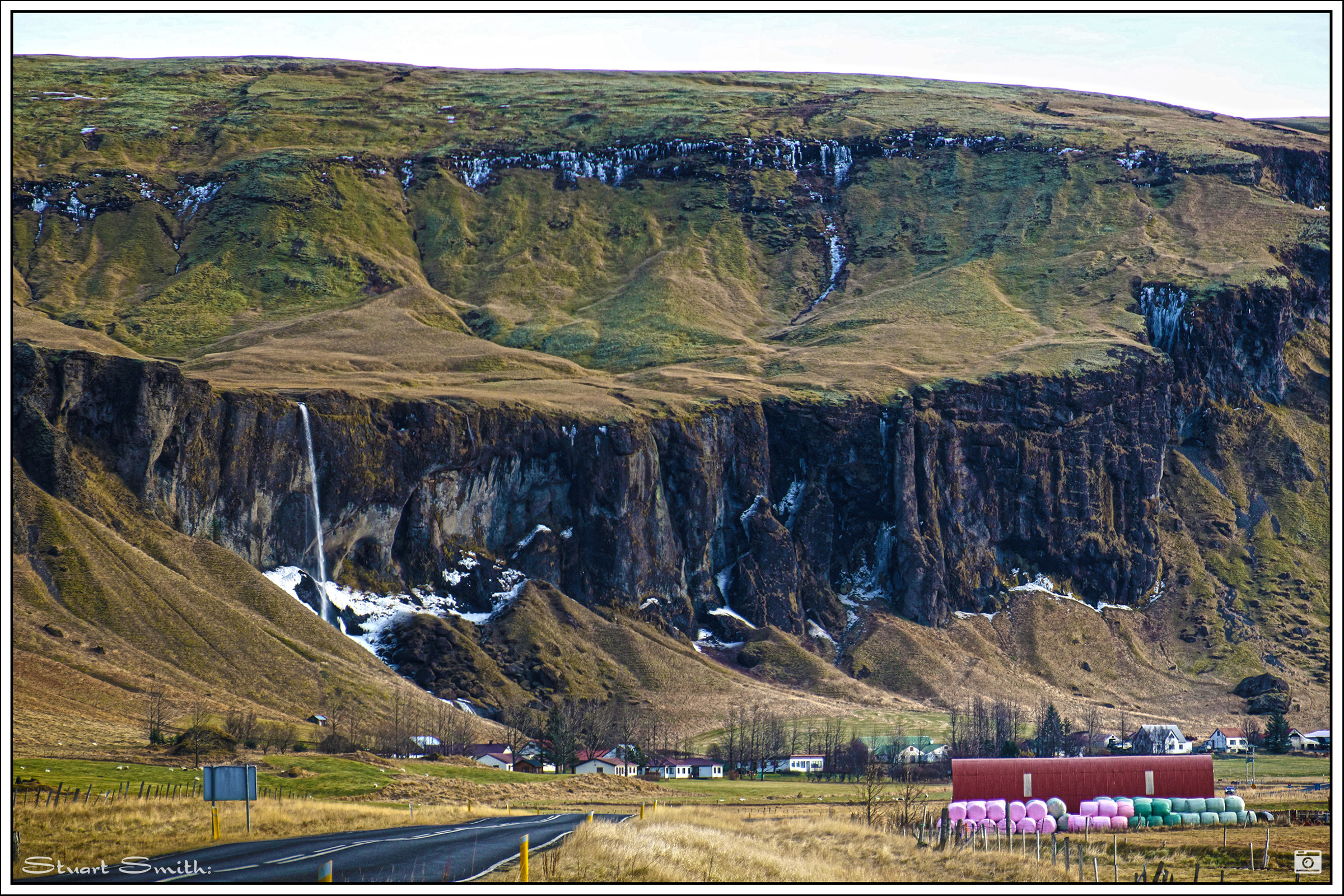
Escarpment, Foss á Síðu, Þjóðvegur, Iceland

