We left Reykjavik and drove along the coastal road eastward toward the town of Vik.
All images are geotagged and hyperlinked to open full screen. To view them on a map, save the image to your hard drive and then download this FREE SOFTWARE. Install and click on the image in the left panel to view in a map as to the location where it was taken. (SAMPLE VIEW)

Iceland – Route taken.

House & Church, Rangarvallavegur, Keldur, Iceland

Cattle, Rangarvallavegur, Keldur, Iceland

Turf Shed, Rangárvallavegur, Keldur, Iceland

Waterway, Rangárvallavegur, Keldur, Iceland

Church, Rangárvallavegur, Keldur, Iceland

Turf Stores, Rangárvallavegur, Keldur, Iceland

Waterway, Rangárvallavegur, Keldur, Iceland

New Arrival, Rangárvallavegur, Keldur, Iceland


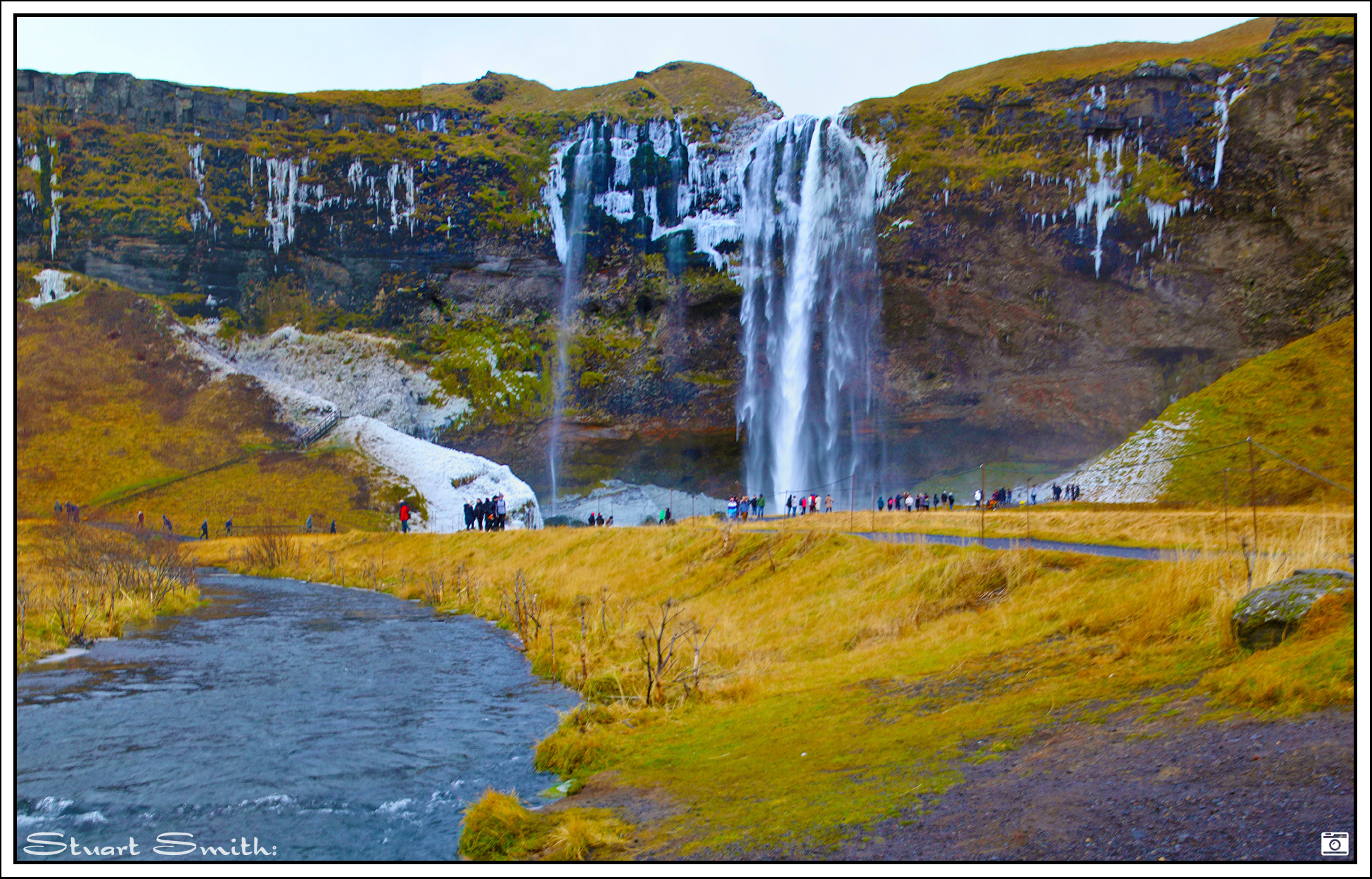
Seljalandsfoss Waterfall, Þórsmerkurvegur, Hvolsvelli, Iceland


Rutshellir Caves, Drangshlíð, Iceland

Mountain, Skógafoss, Iceland


Skógafoss Waterfall, Skógafoss, Iceland

Mountain, Skógafoss, Iceland

Landscape, Þjóðvegur, Sólheimasandur, Iceland

Machinery Remnants, Dyrhólaey, Vik, Iceland
I have not been able to find any information regarding this, there were more than one about the place. I get the impression it may have had something to do with cables as in an pivot for running a cable to haul something. It is located atop a very high ocean edge cliff.

Reynisdrangar, Vik, Iceland
Reynisdrangar is the name given to the rock formations.


Arnardrangur, Reynisfjara, Vik, Iceland
Reynisfjara is the black sand beach and Arnardrangur the name of the rock formation.

Sea Cliffs, Dyrhólaey, Vik, Iceland

Rock Formations, North Atlantic Ocean, Dyrhólaey, Vik, Iceland

Kirkjufjara Beach, Vik, Iceland

Coastal Stretch, Dyrhólaey, Vik, Iceland

