REMEMBER: All images will open in a new window/tab, All images are geotagged and can be viewed on a map using:- Geosetter Software (download here)
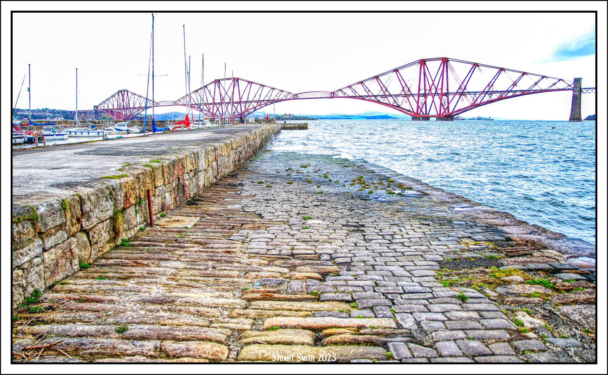
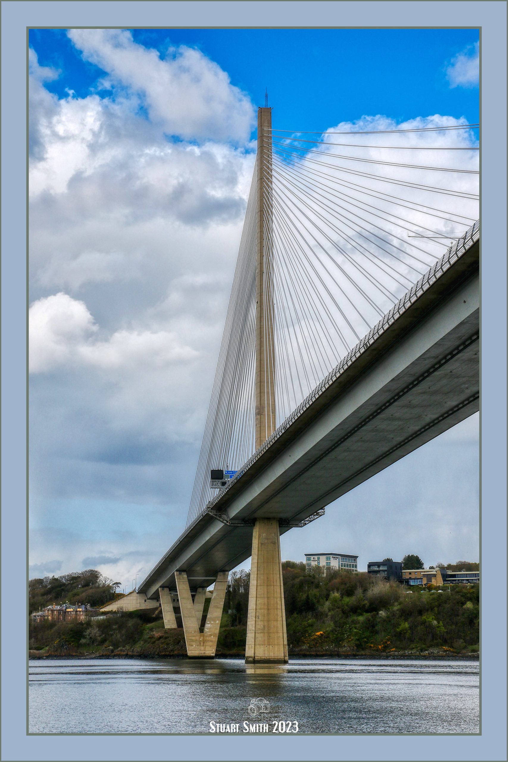
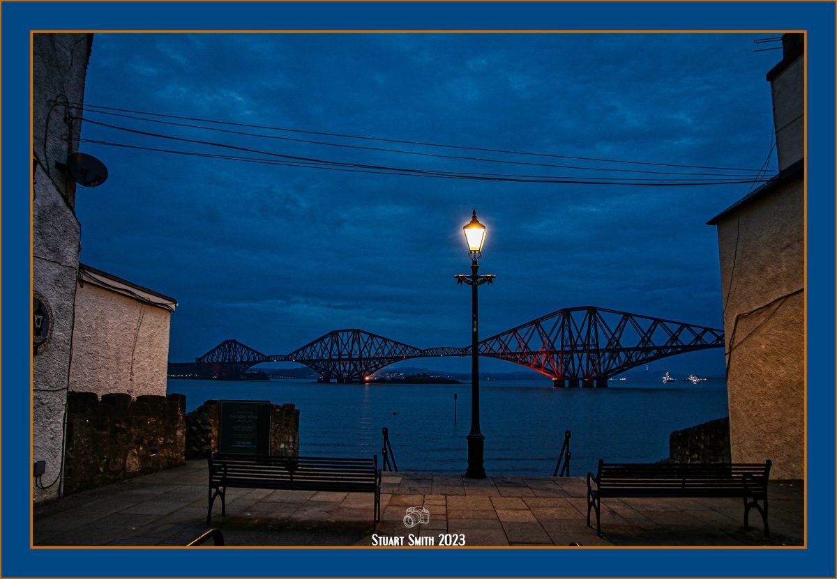
 Firth of Forth Bridges, South Queensferry, West Lothian, Scotland UK
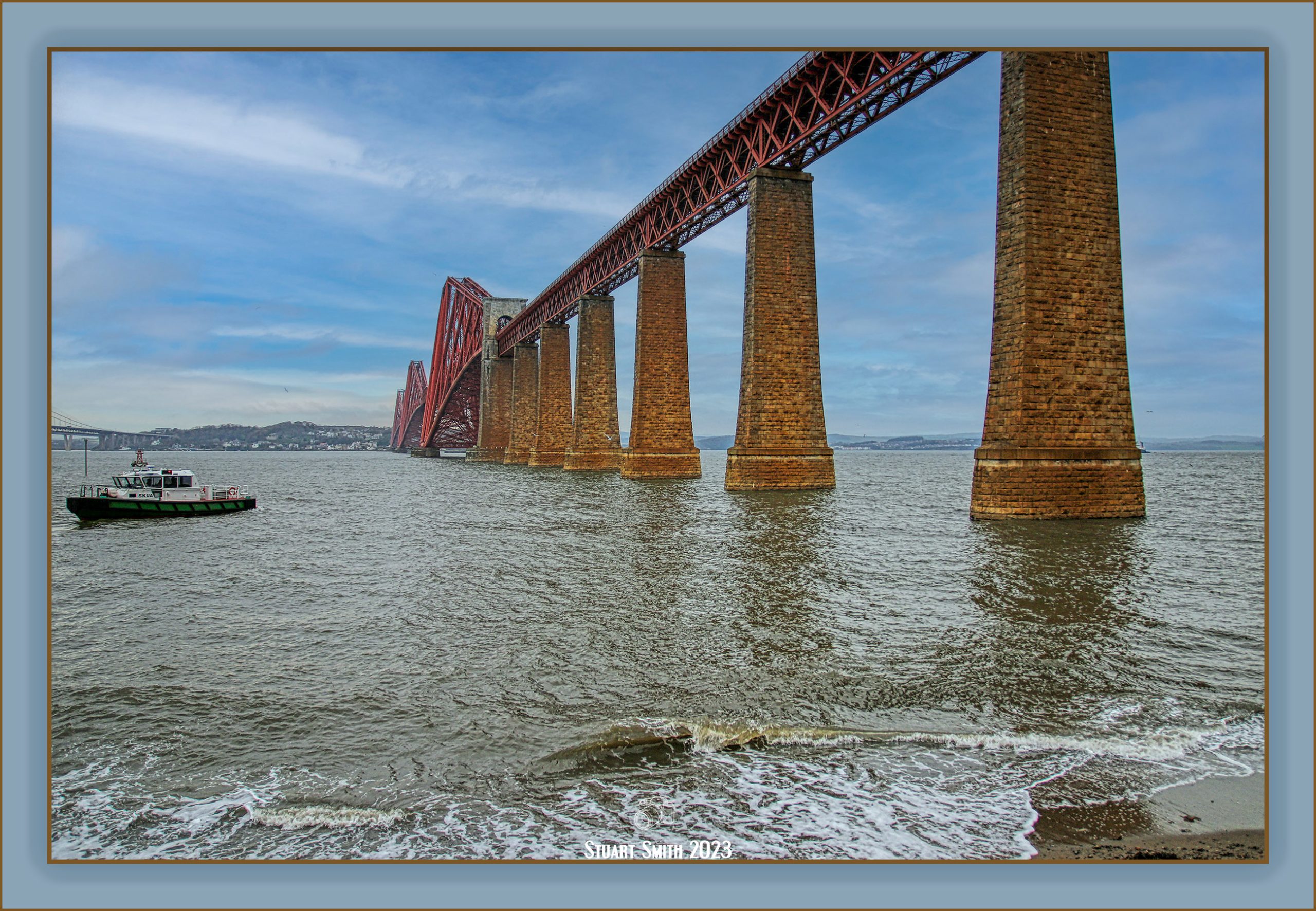
The “Forth Rail Bridge” on the right, was opened in 1890 and is a UNESCO Wold Heritage site. The “Forth Road Bridge” the central bridge was opened 1963 and the newest bridge is “Queensferry Crossing” which opened in 2017 and is on the far left.


 South Queensferry Lighthouse, Hawes Pier, South Queensferry, West Lothian, Scotland UK
A category B listed building since 1971, it was built by the Scottish civil engineer John Rennie in 1812, probably in collaboration with Robert Stevenson of Bell Rock fame, and is contemporary with the pier itself (also a Rennie work). It was a beacon to guide the ferry which operated between Hawes Pier and North Queensferry before being made redundant by the construction of the Forth Road Bridge in 1964.
 Rusted Mooring Ring, Hawes Pier, South Queensferry, West Lothian, Scotland UK
 Hawes Pier, Firth of Forth, South Queensferry, West Lothian, Scotland UK
The pier was also constructed by Rennie in 1812.
 Old Roadside Marker, Edinburgh Road, South Queensferry, West Lothian, Scotland UK
 Former ‘Seals Craig Hotel‘, 23 Edinburgh Road, South Queensferry, West Lothian, Scotland UK
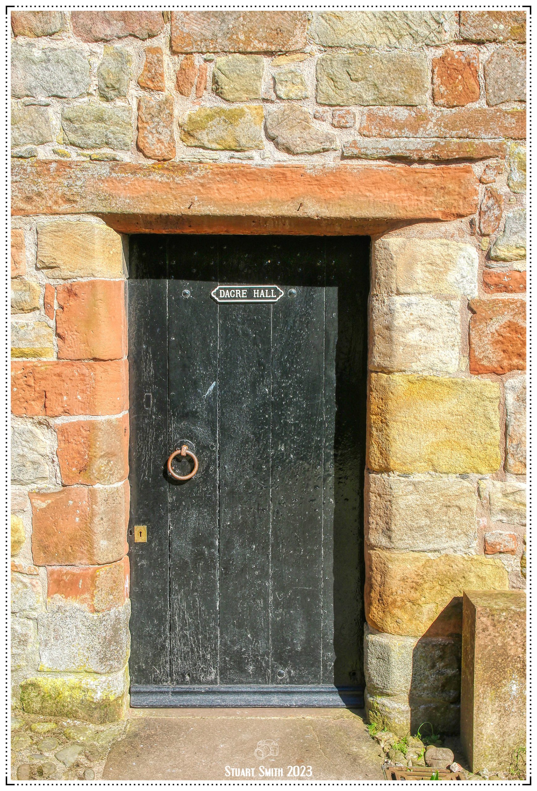
 Doors of South Queensferry, West Lothian, Scotland UK
 Brass Plate, Vennel Kirk, The Vennel, South Queensferry, West Lothian, Scotland UK
The church has now been converted to a private residence.
 Masonic Lodge & South Queensferry Mosaic Mural, The Vennel & Hawthorn Bank, South Queensferry, West Lothian, Scotland UK
The first school in Queensferry was at the top end of the churchyard of the Old Parish Church in the Vennel. In July 1671, it was decided to build a school using local stonework, at the south end of churchyard. The school was ready for occupancy in 1672 and still stands today as the Masonic Lodge.
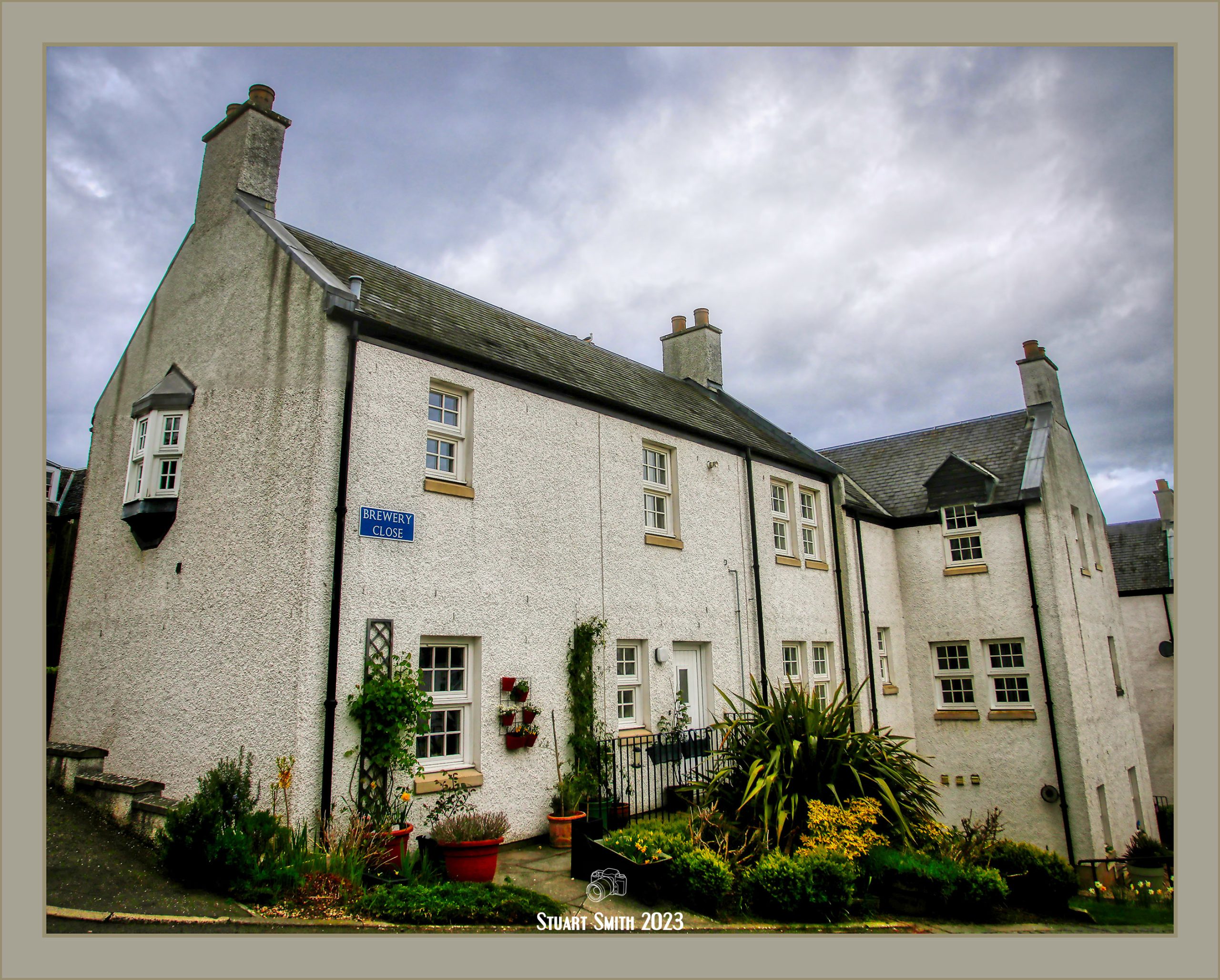
 Residential Block, Brewery Close, South Queensferry, West Lothian, Scotland UK
 Jubliee Clock Tower from The Loan, South Queensferry, West Lothian. Scotland UK

“Loan House”, 10 The Loan, South Queensferry, West Lothian, Scotland UK
Category B Listed Building
The property fell vacant in the later 20th century and was gutted by fire in 1987. In 1990 the building was restored, with the addition of a north wing, by Douglas Abrahams and Partners for use as offices. As a result of the fire the original interior was lost and the interior of the building had to be rebuilt. Now Scottish Motor Trading Association Offices.
 “Priory Lodge”, 8 The Loan, South Queensferry, West Lothian, Scotland UK
Category c Listed Building – 19th century gothic. This house is the only example of this style in the town centre.

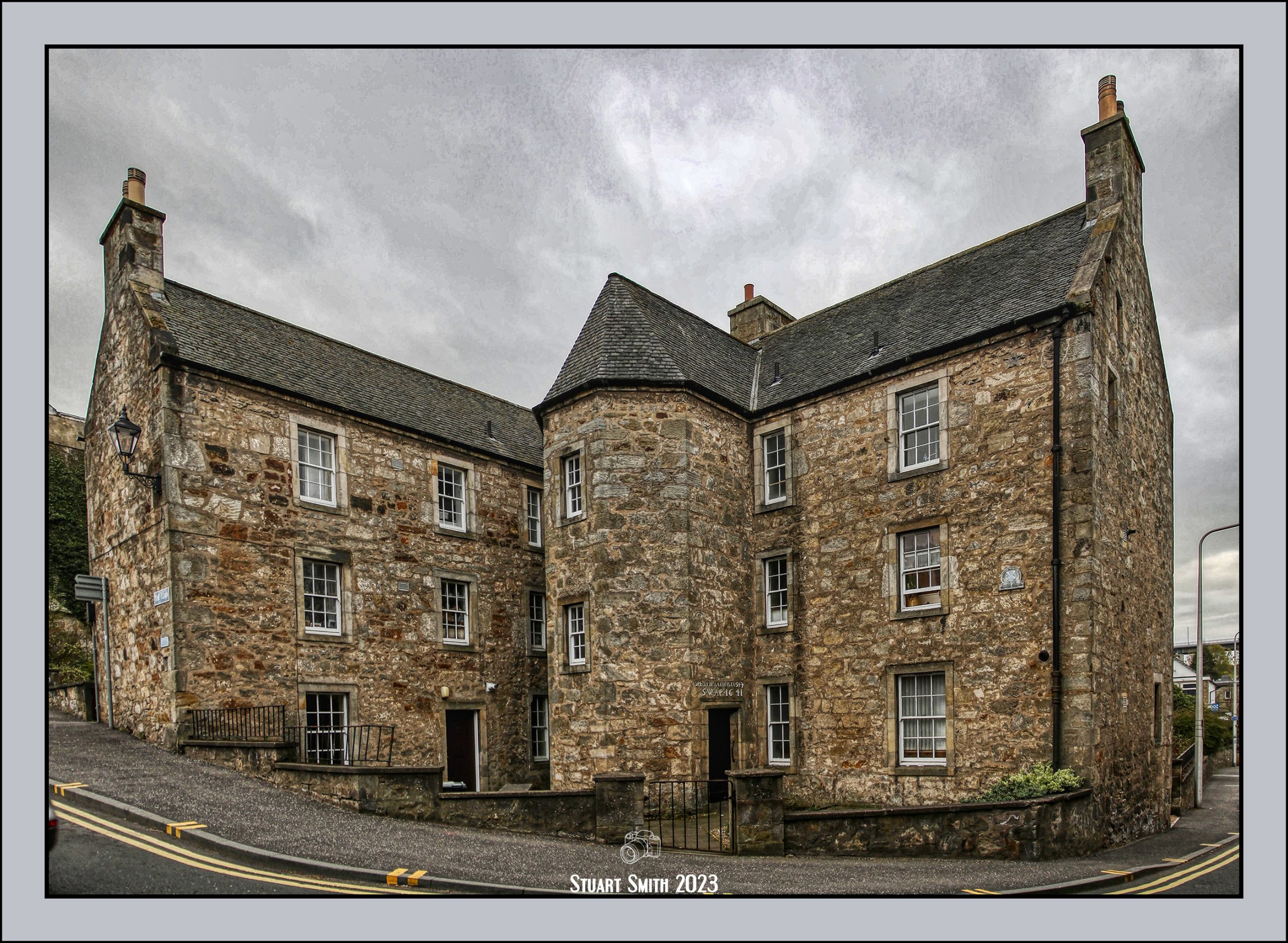
 Plewlands House, Cnr The Loan & Hopetoun Road, South Queensferry, West Lothian, Scotland UK
Plate – The National Trust for Scotland
Door – Marriage Lintel
The inscription above the door reads :-
[SPES MEA CHRISTUS, ‘Christ is my Hope’, and an anchor which indicates the occupation of the owner of the house. SW-AP were carved in relief with the year of the building, 1641.]
C.1641 – See its history here!
 Priory Church of St Mary of Mount Carmel, Cnr Rose Lane & Hopetoun Road, South Queensferry, West Lothian, Scotland UK
Now a grade A listed building, the Priory Church is the only Carmelite foundation in the British Isles still in use for regular worship, out of the 12 founded in Scotland and the 39 in England.
George, the Laird of Dundas, invited the Carmelite Friars to come and settle in Queensferry around 1330. They were in temporary buildings until a century later. Architectural style suggests this was built no earlier than 1457.
 Door Knocker, Priory Church of St Mary of Mount Carmel, Cnr Rose Lane & Hopetoun Road, South Queensferry, West Lothian, Scotland UK
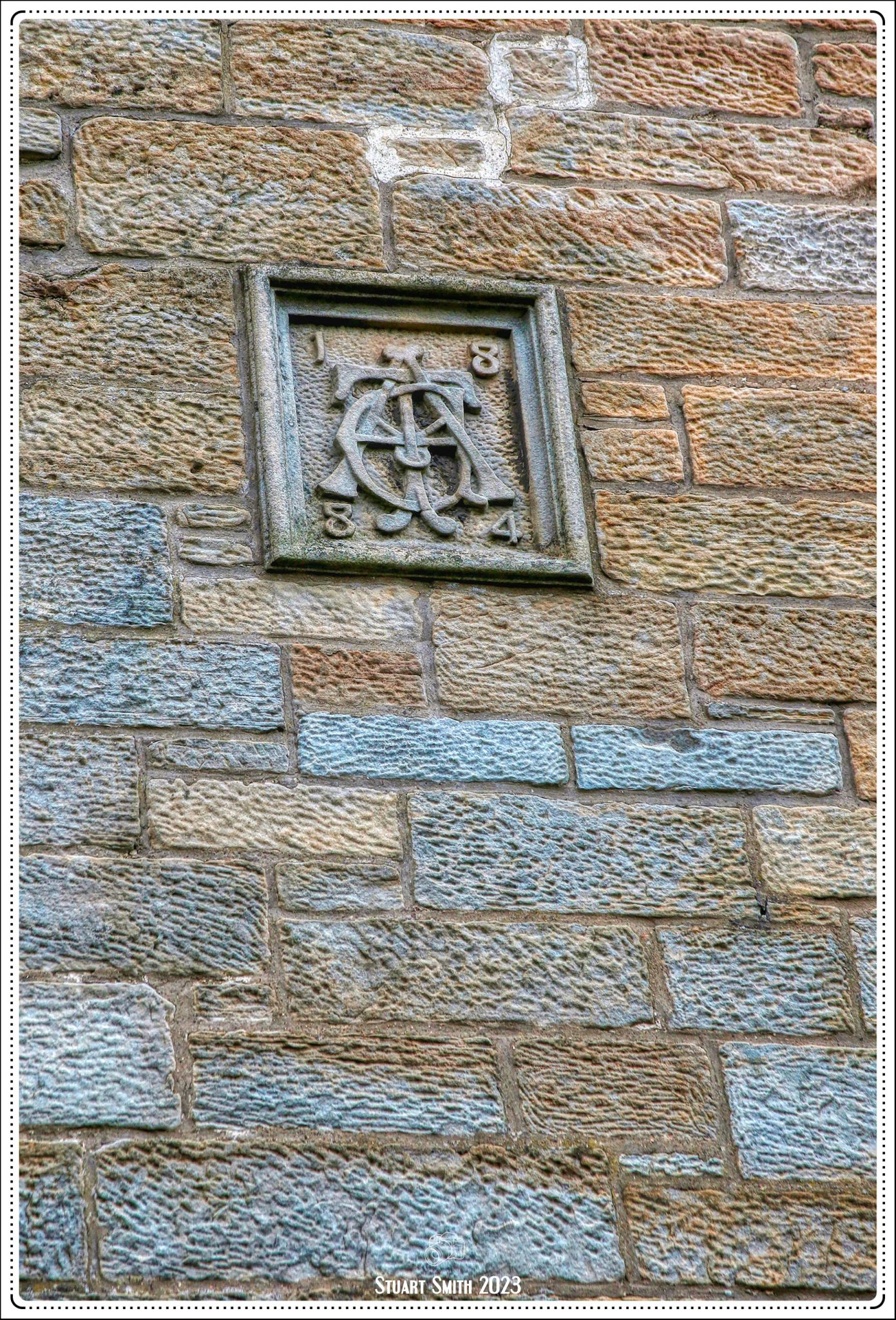 “1884”, Rose Lane, South Queensferry, West Lothian, Scotland UK
Unfortunately I have not been able to find any information to identify this symbol. It does look like what may have been an early Masonic Symbol.
 Bellstane Bird, Bellstane, South Queensferry, West Lothian, Scotland UK
Bellstane takes its name from the ringing of the bell which was rung to tell people the market was about to start. The actual bell is now in Queensferry museum.

 Harbour Lane, South Queensferry, West Lothian, Scotland UK


 Bay View, Gote Lane, South Queensferry, West Lothian, Scotland UK
 Forth Rail Bridge, Firth of Forth, South Queensferry, West Lothian, Scotland UK
 Slipway, Gote Lane, South Queensferry, West Lothian, Scotland UK
 Dedication Plaque, Rosebery Hall, High Street, South Queensferry, West Lothian, Scotland UK
 Memorial to John Reid, High Street, South Queensferry, West Lothian, Scotland UK
Inscription:- In Memory Of
John Reid
Provost of the Burgh
Of South Queensferry
1884 – 1899
 Waterside Residential, High Street, South Queensferry, West Lothian, Scotland UK
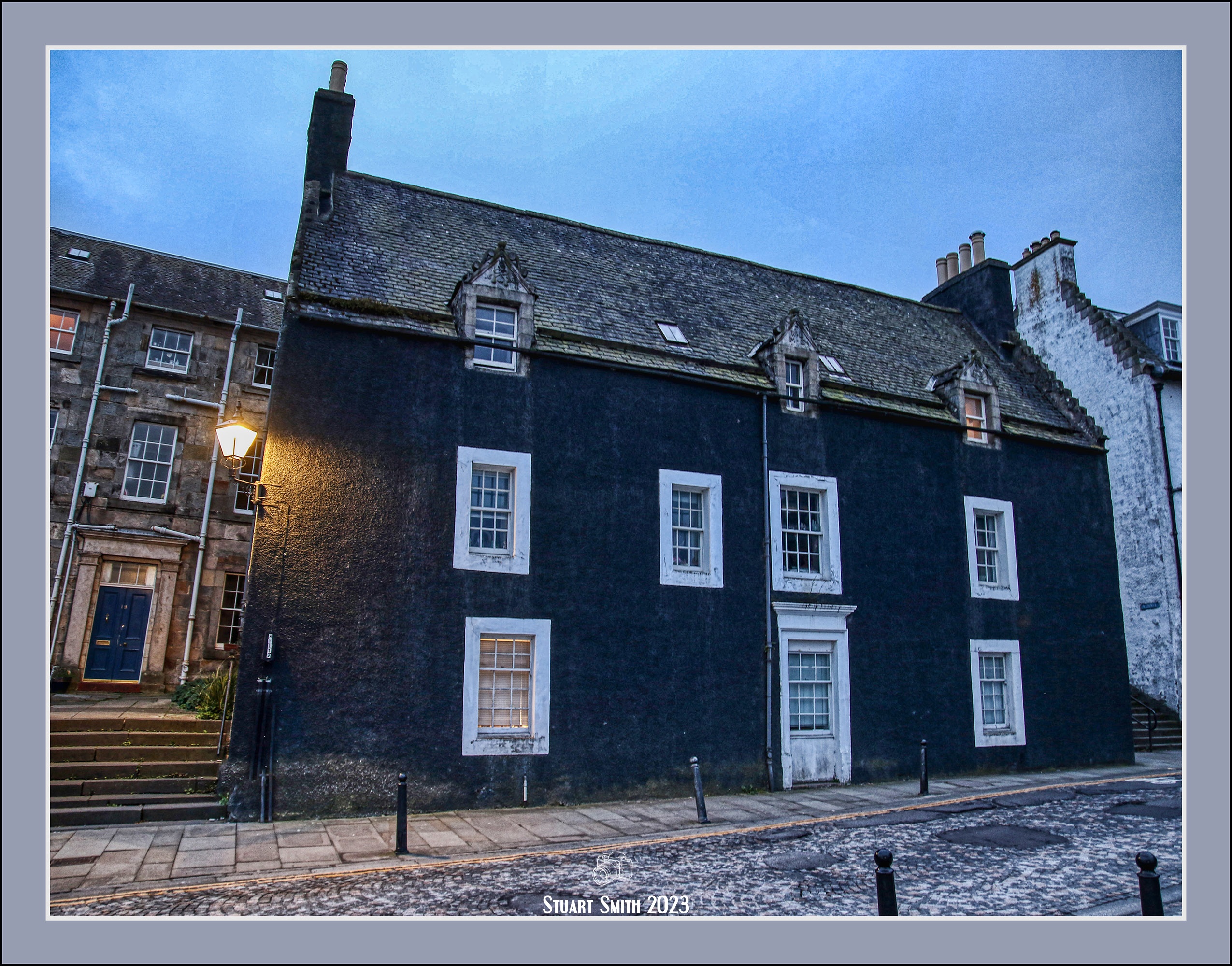
 “Black Castle”, 43 High Street, South Queensferry, West Lothian, Scotland UK
Category “A” Listed Building c. 1626. In 1626 mariner and explorer Willam Lowrie built the house for him and his wife Marion Speddie to live in and it is believed that the home would have originally been sandstone in colour. The name was most likely adopted during the “Witch Hunts” of the 1640s.
 Scrolls, “Black Castle”, 43 High Street, South Queensferry, West Lothian, Scotland UK
The upper floor of Black Castle has 3 sets of windows, each with carvings and scroll details. The eaves above two of the dormer windows bear the date of construction (1626), along with Lowrie’s and Speddie’s initials. (WL – MS)
See a history surrounding its macabre story.
 Old Well Head, High Street, South Queensferry, West Lothian, Scotland UK
A site where locals were able to draw water
 Door Steps, Edinburgh Road, South Queensferry, West Lothian, Scotland UK
 Belhaven Sign, Anchor Inn, Edinburgh Road, South Queensferry, West Lothian, Scotland UK


 Interior scenes of Hawes Inn, Newhalls Road, South Queensferry, West Lothian, Scotland UK
 “Weihenstephan”, Orocco Pier Hotel, High Street, South Queensferry, West Lothian, Scotland UK


 The view of the village from the castle walls


 Etched into the walls of the “dungeon”


 Uhtred of Bebbanburg


 Doorway of Former 'Seals Craig Hotel', 23 Edinburgh Road, South Queensferry, West Lothian, Scotland UK


 Trinity Church, Cnr Newcastle & Oxnam Roads, Jedburgh, Roxburghshire, Scotland UK


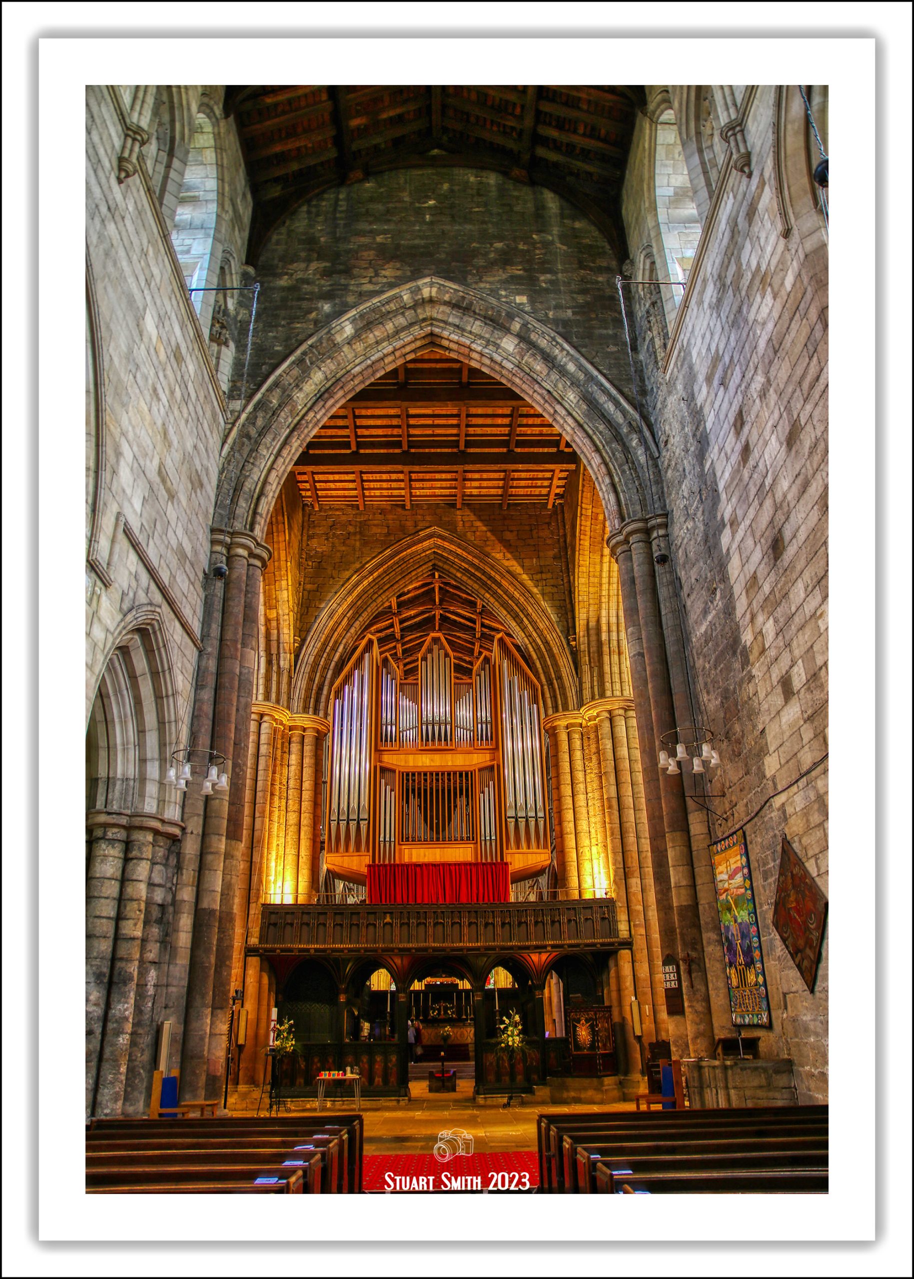


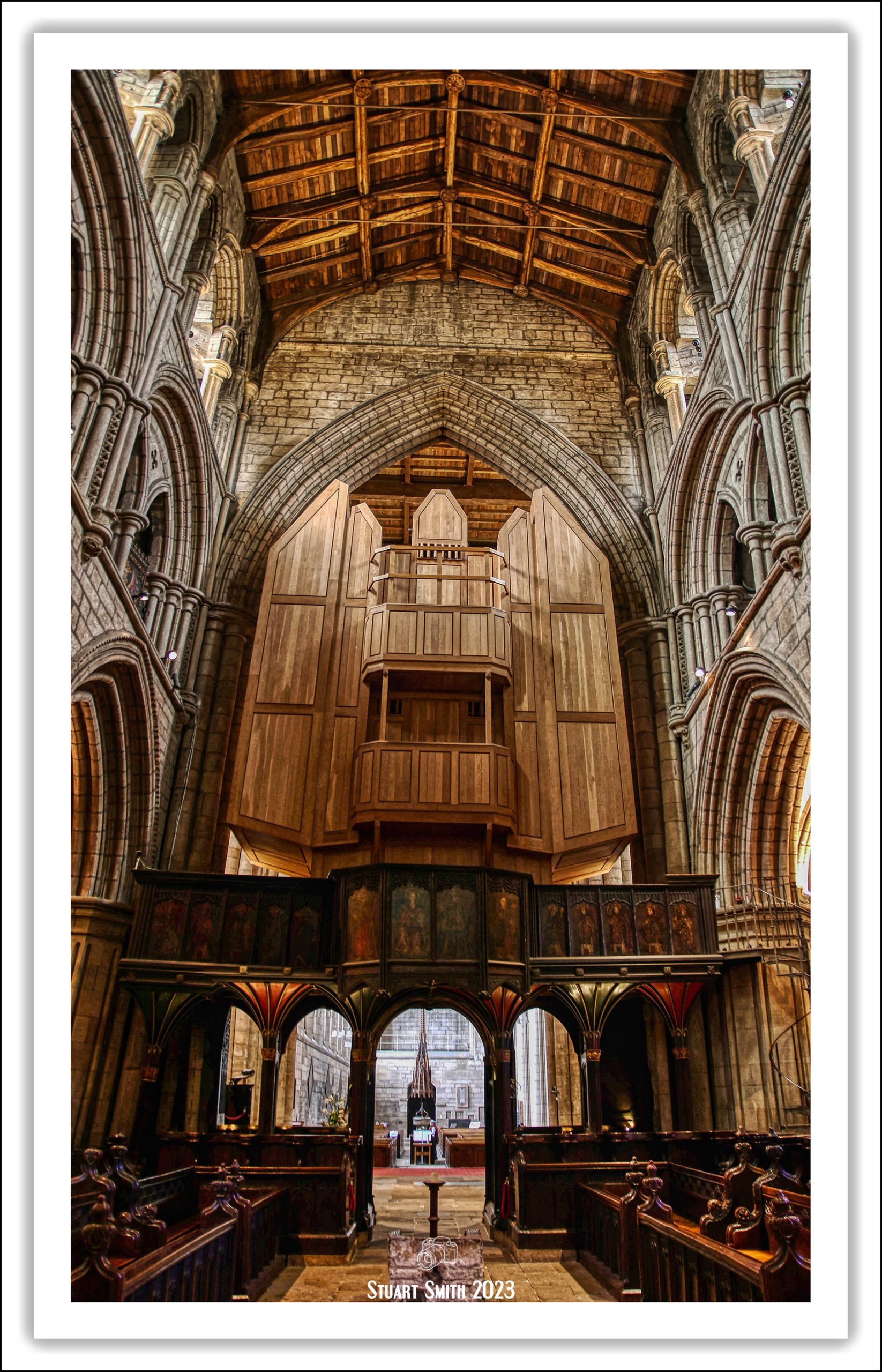


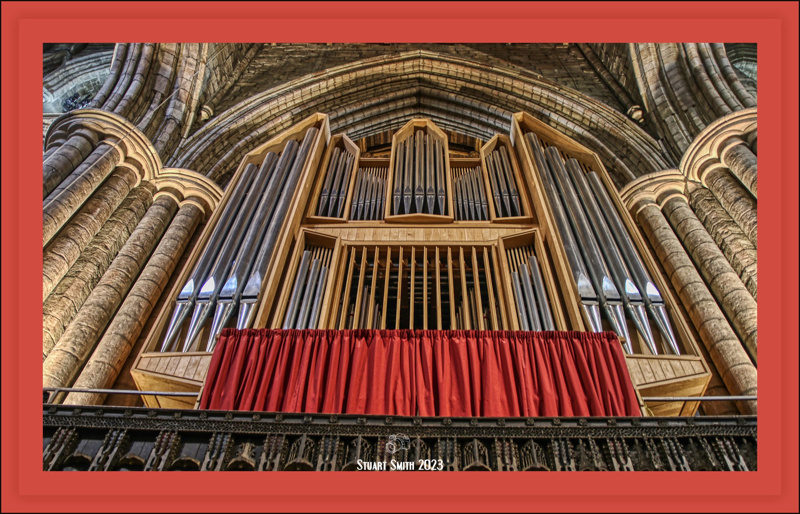
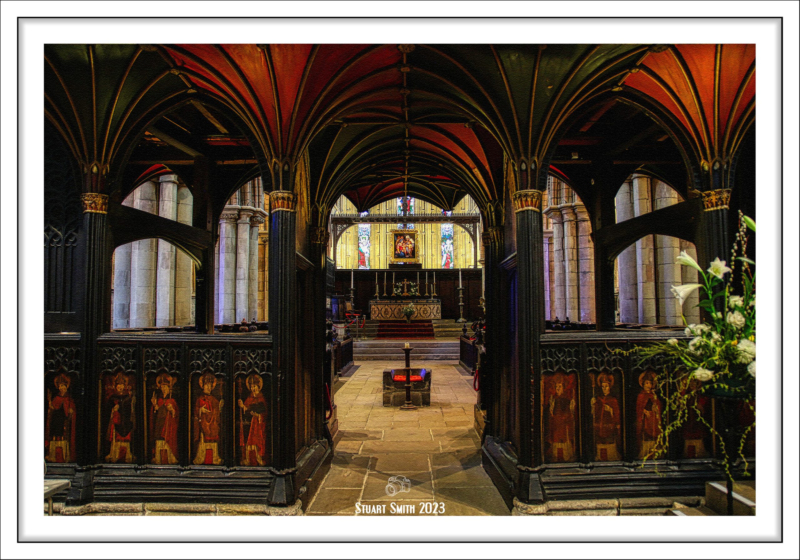


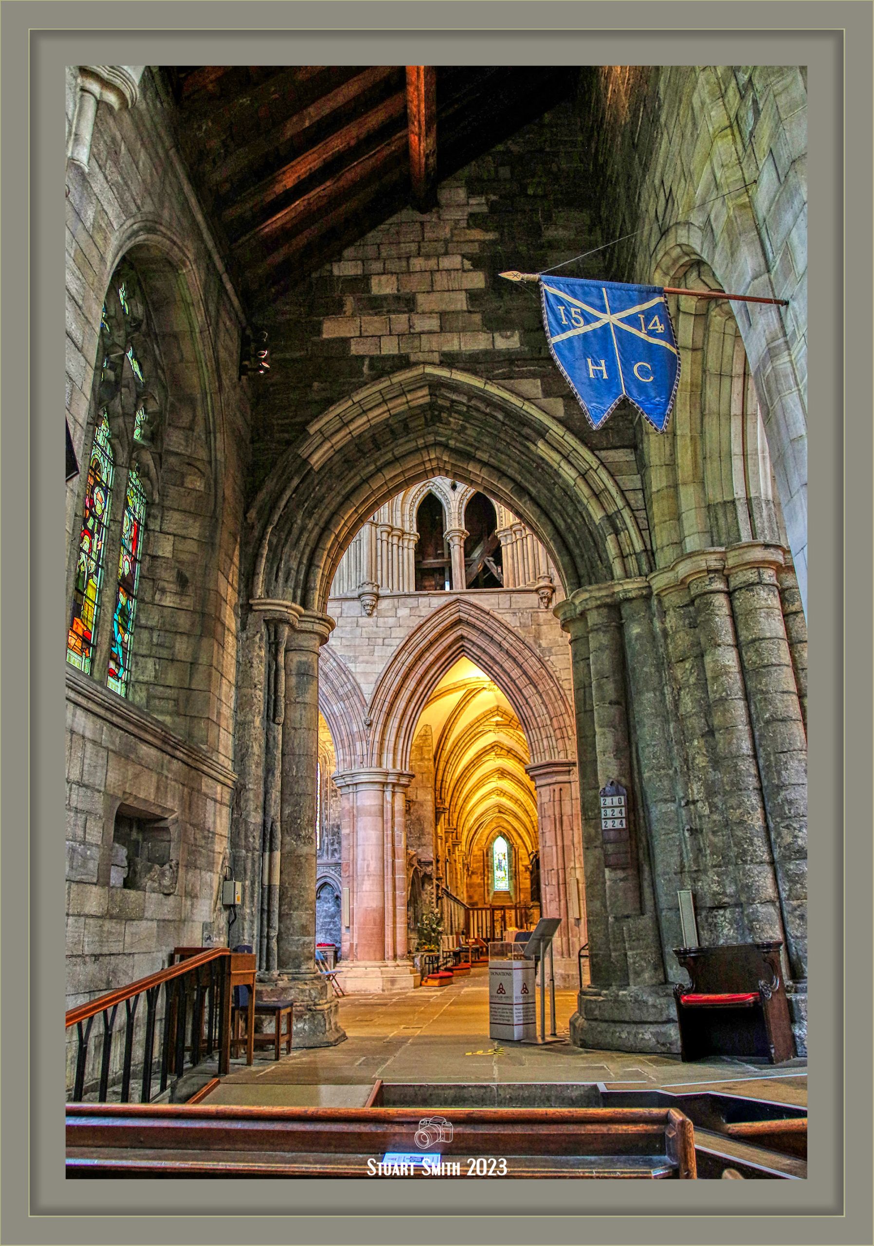


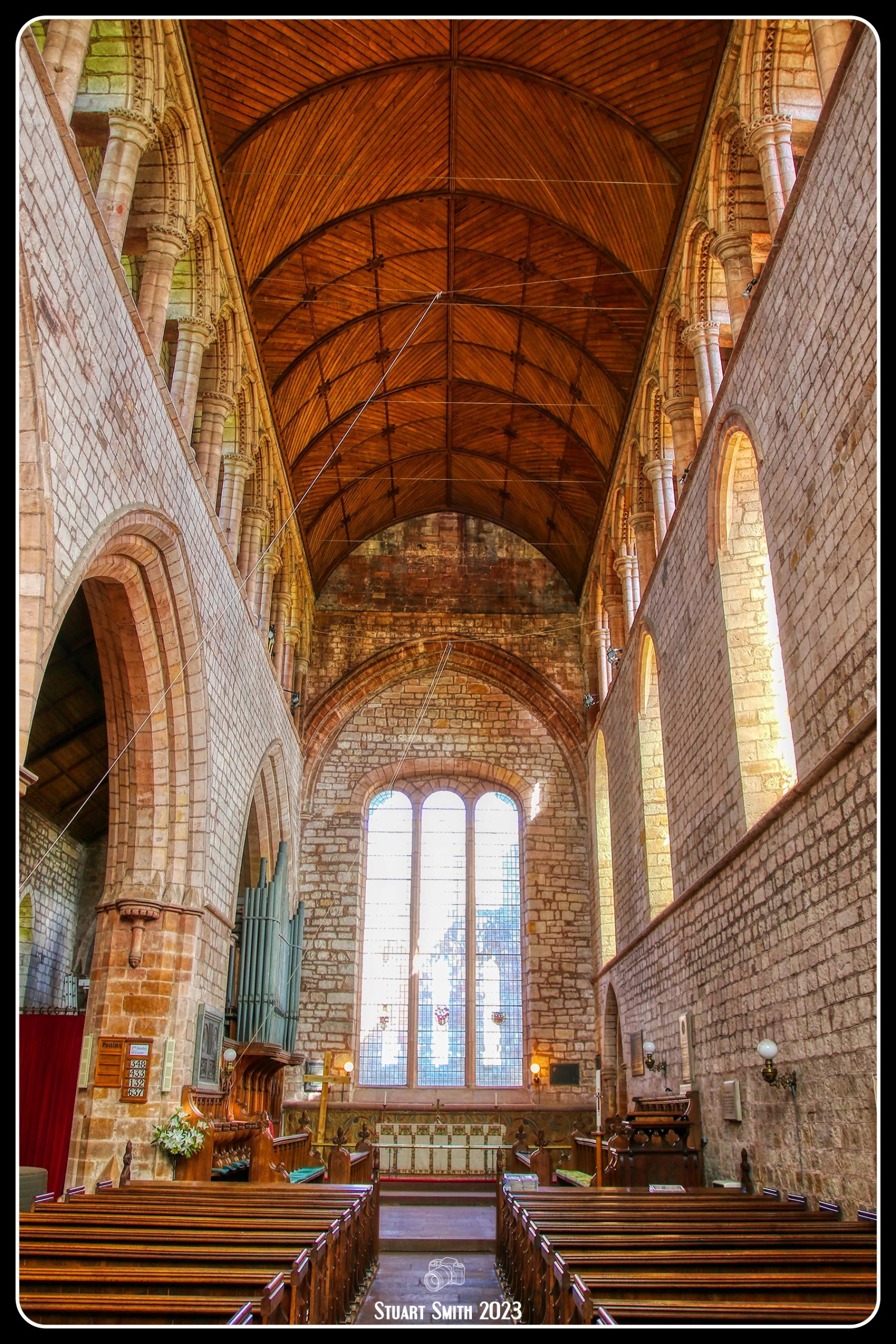
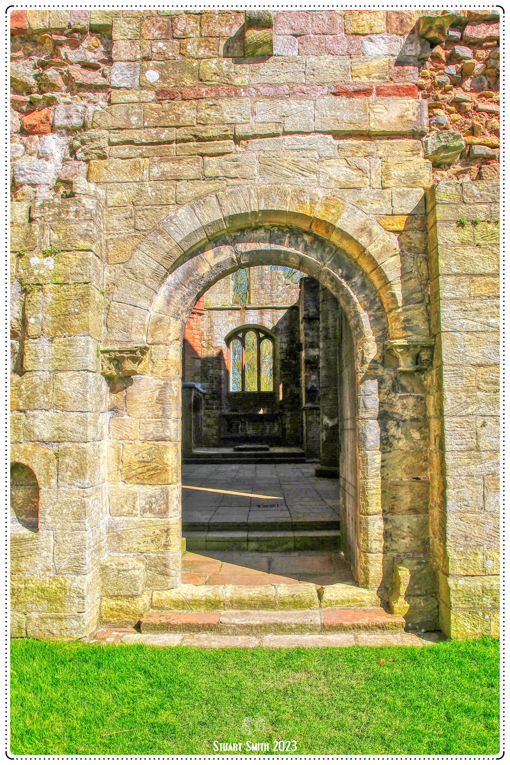
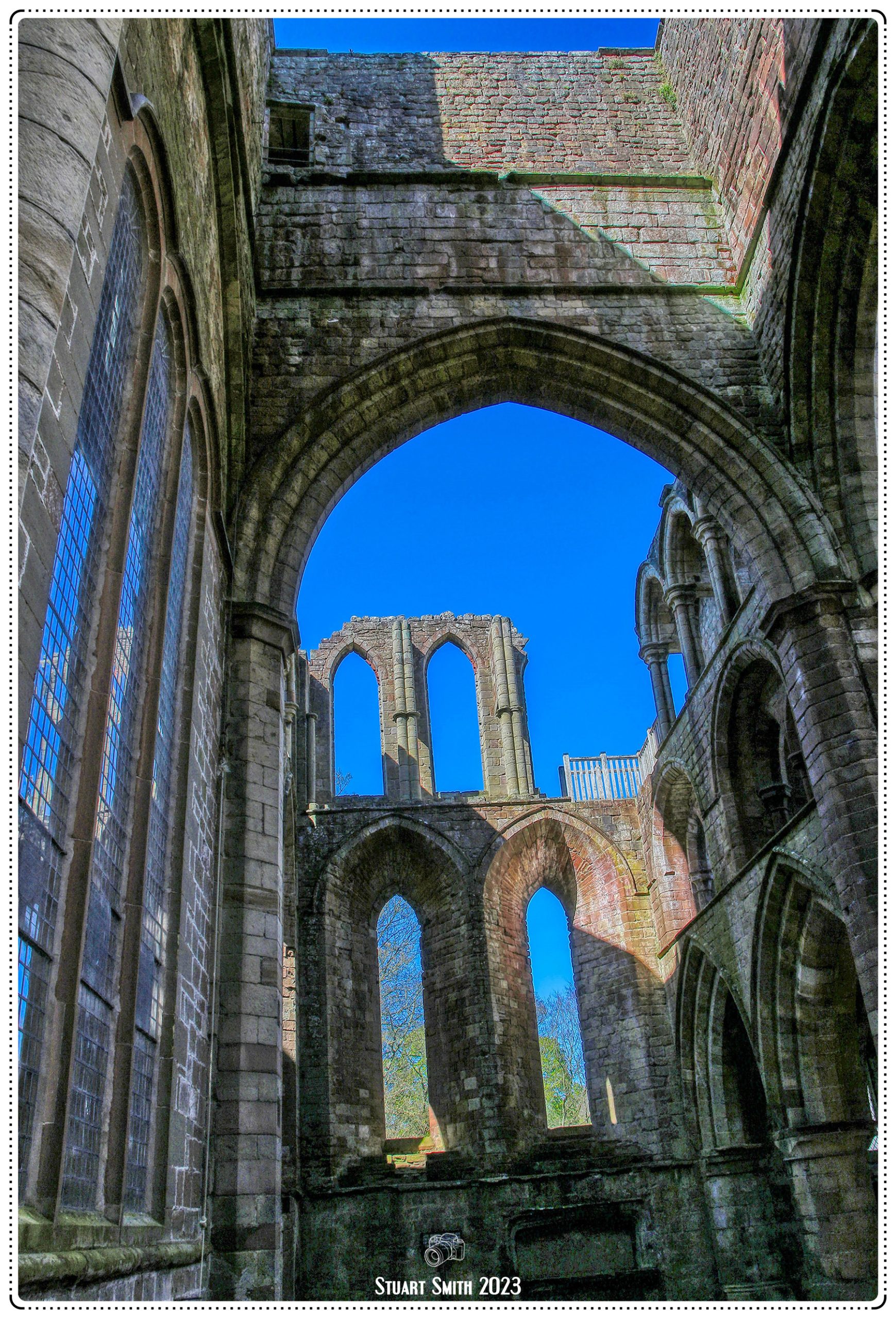
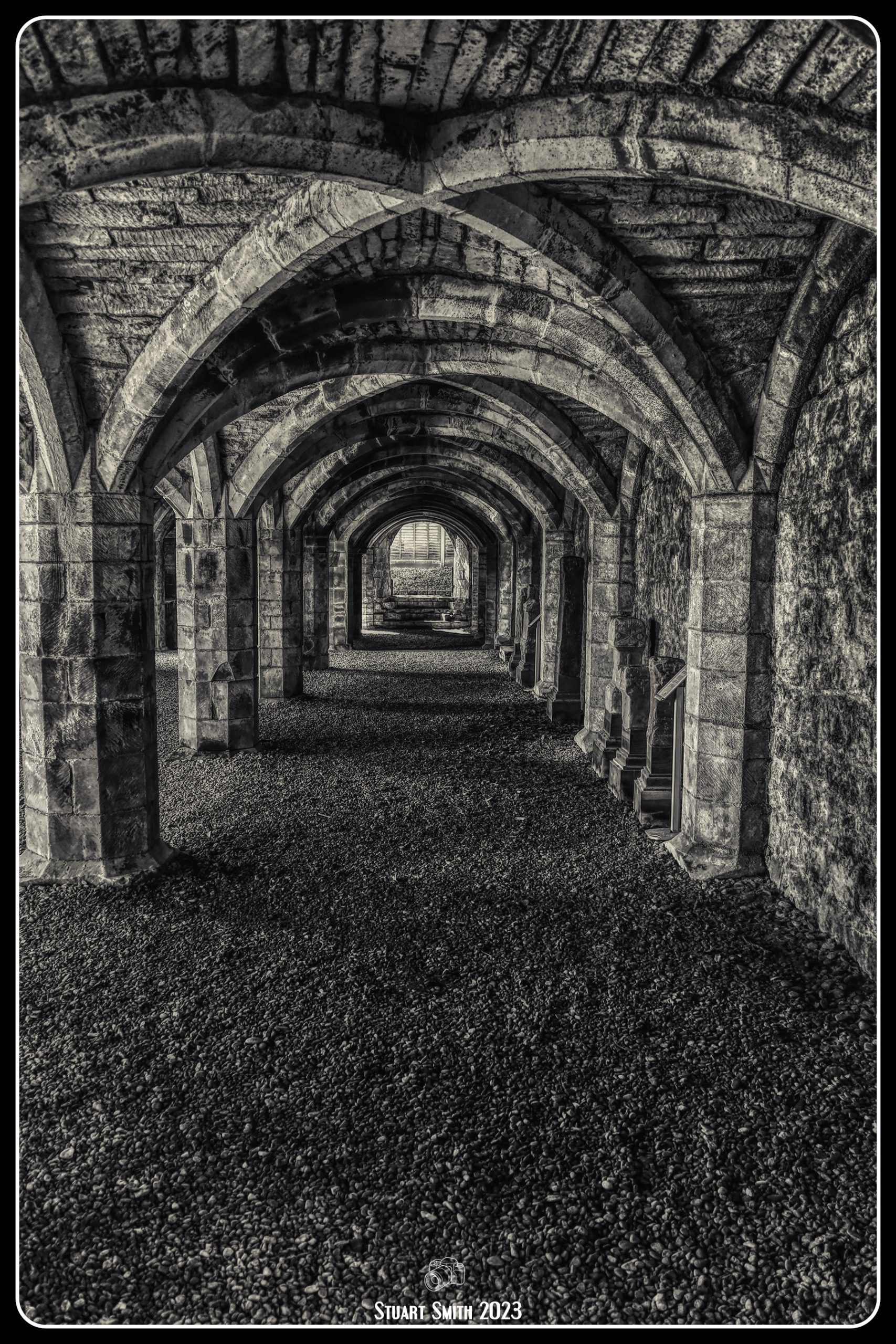
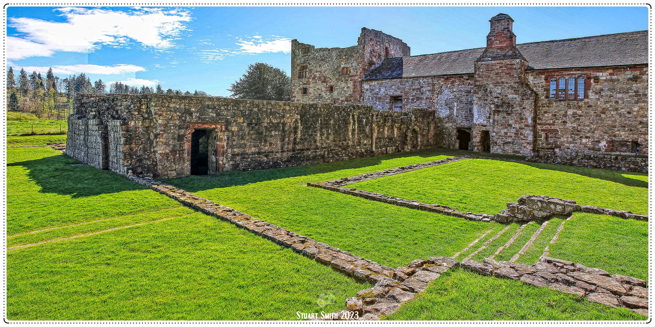
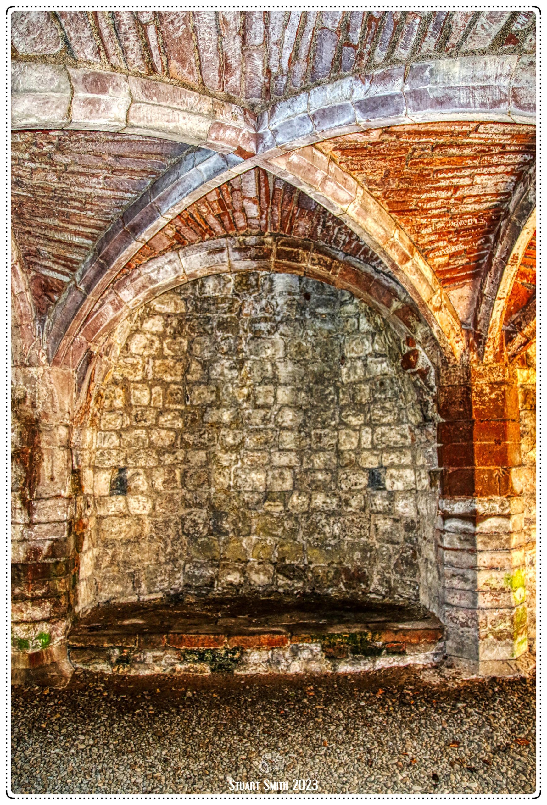
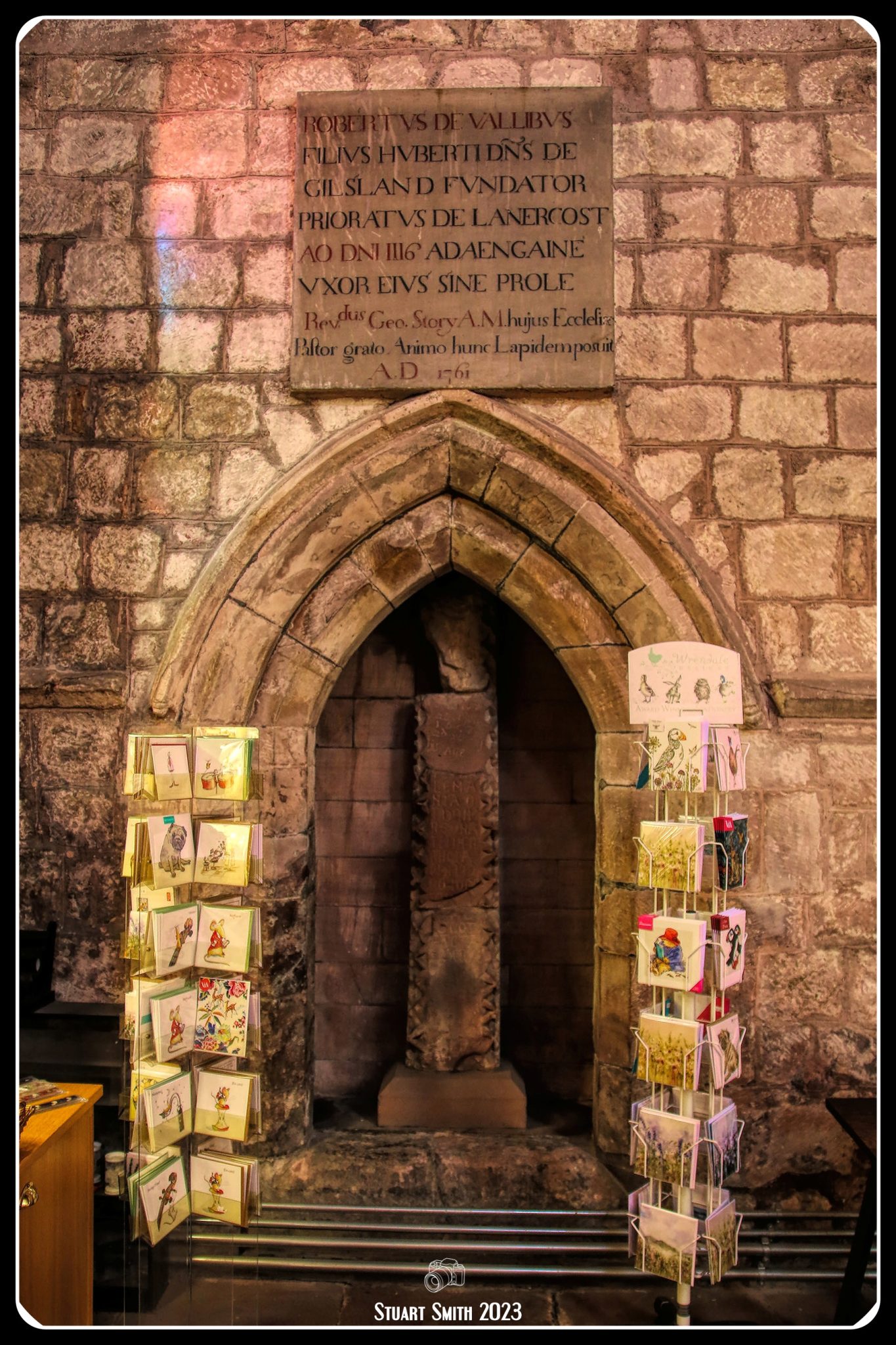 Interior, Church of St Mary Magdalene, Lanercost, Brampton, Cumbria, England UK