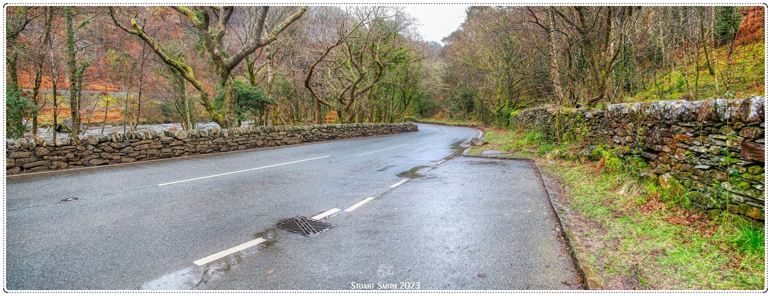
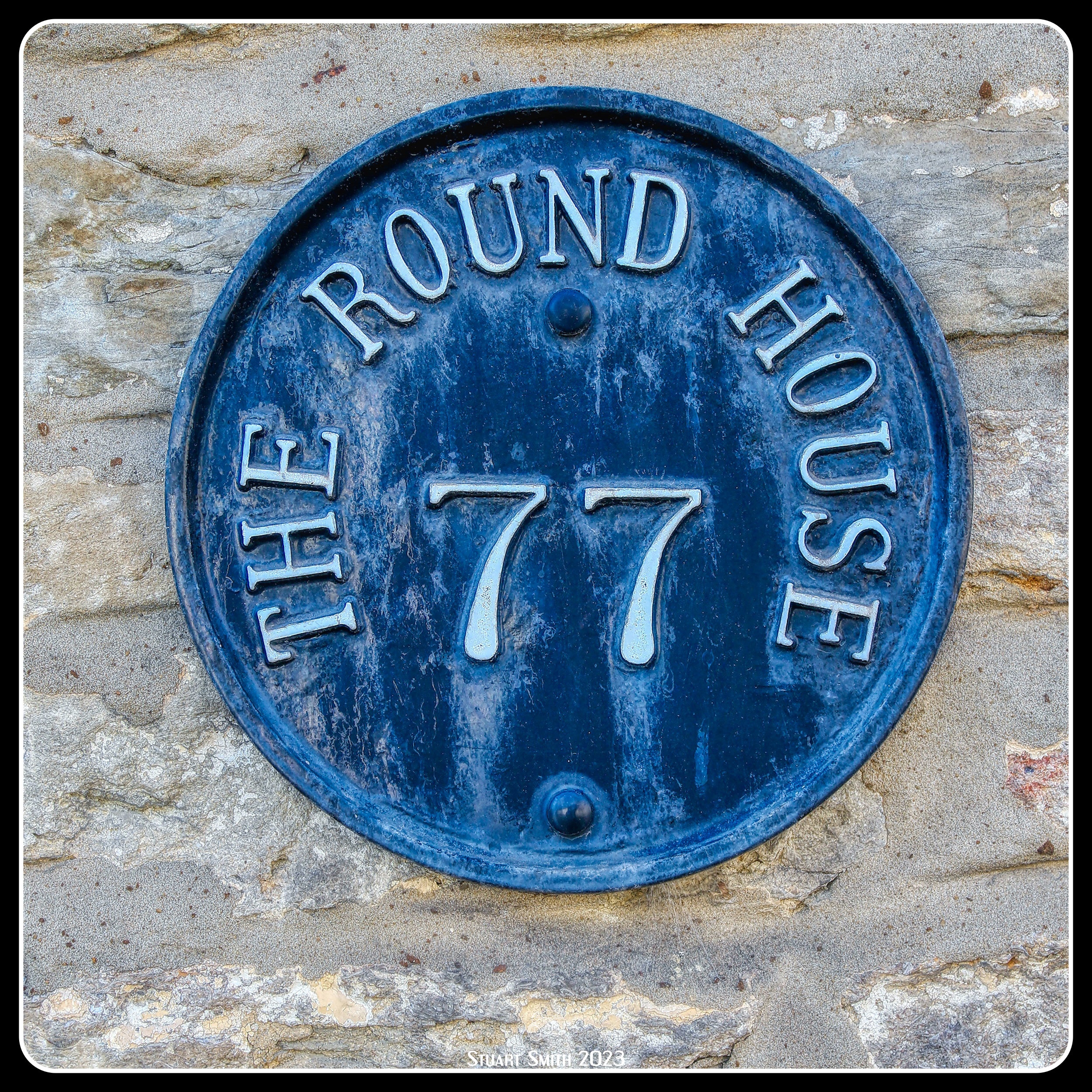
We have had our wonderful stay in The Cotswolds and now head onward….. passing through Cirencester again and on to Wales.
 Doorway, Castle Street, Cirencester, Gloucestershire, England UK
 War Memorial, Market Place, Cirencester, Gloucestershire, England UK
 Tower, Church of St John the Baptist, Market Place, Cirencester, Gloucestershire, England UK
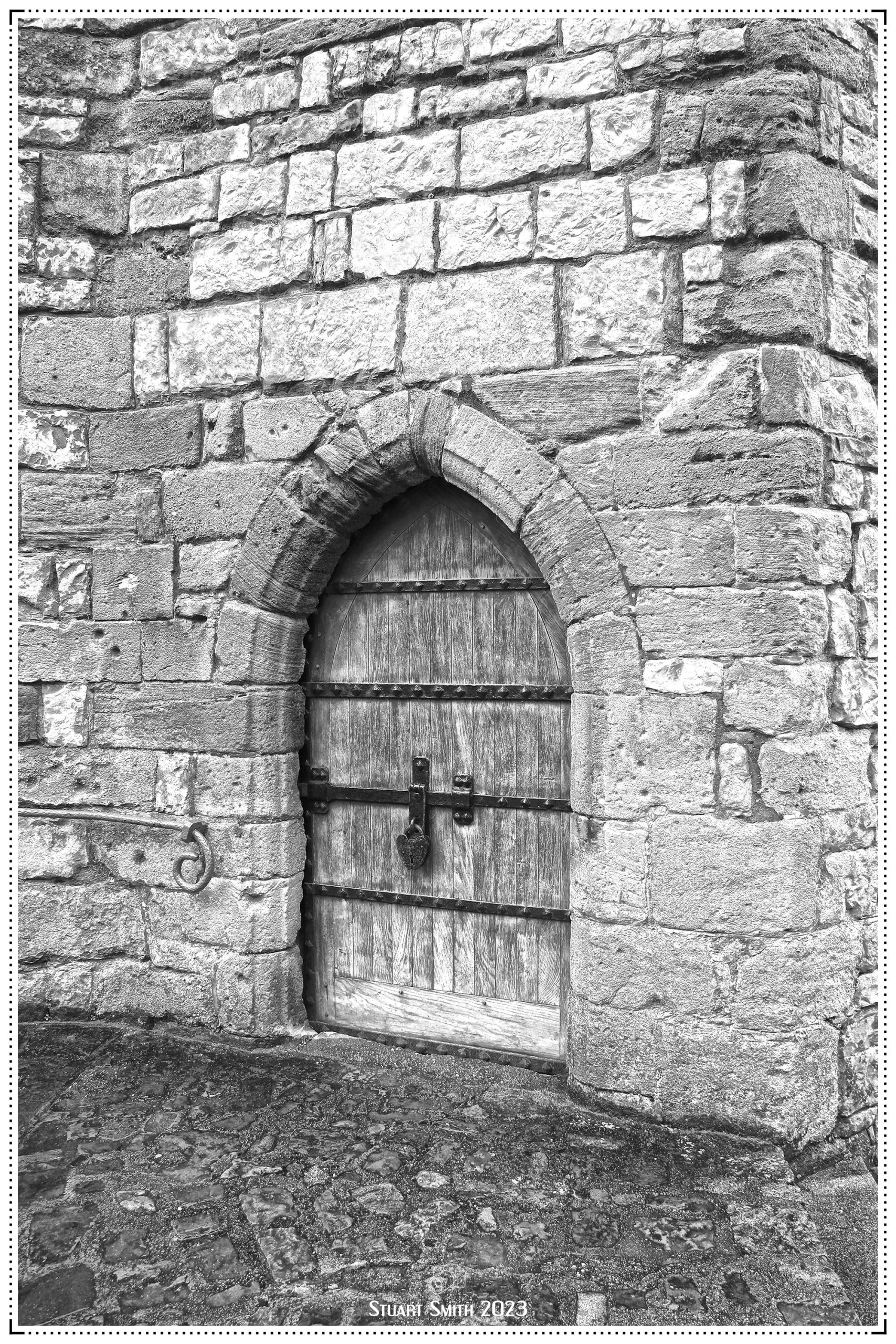
 Door, Church of St John the Baptist, Market Place, Cirencester, Gloucestershire, England UK
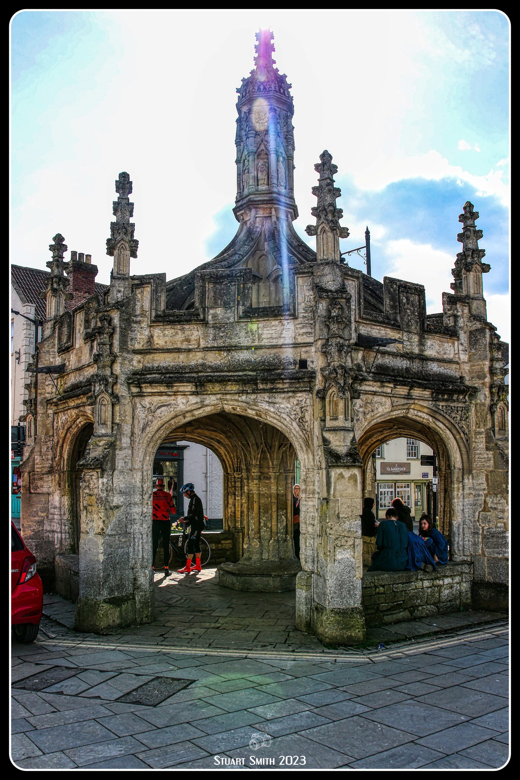
 Stone Cross, Church of St John the Baptist, Market Place, Cirencester, Gloucestershire, England UK
The church is a Grade I Listed Building and originates from the 12th century
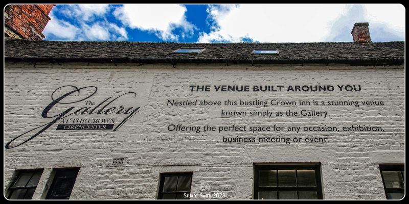 The Gallery at The Crown, Black Jack Street, Cirencester, Gloucestershire, England UK
 10 Black Jack Street, Cirencester, Gloucestershire, England UK
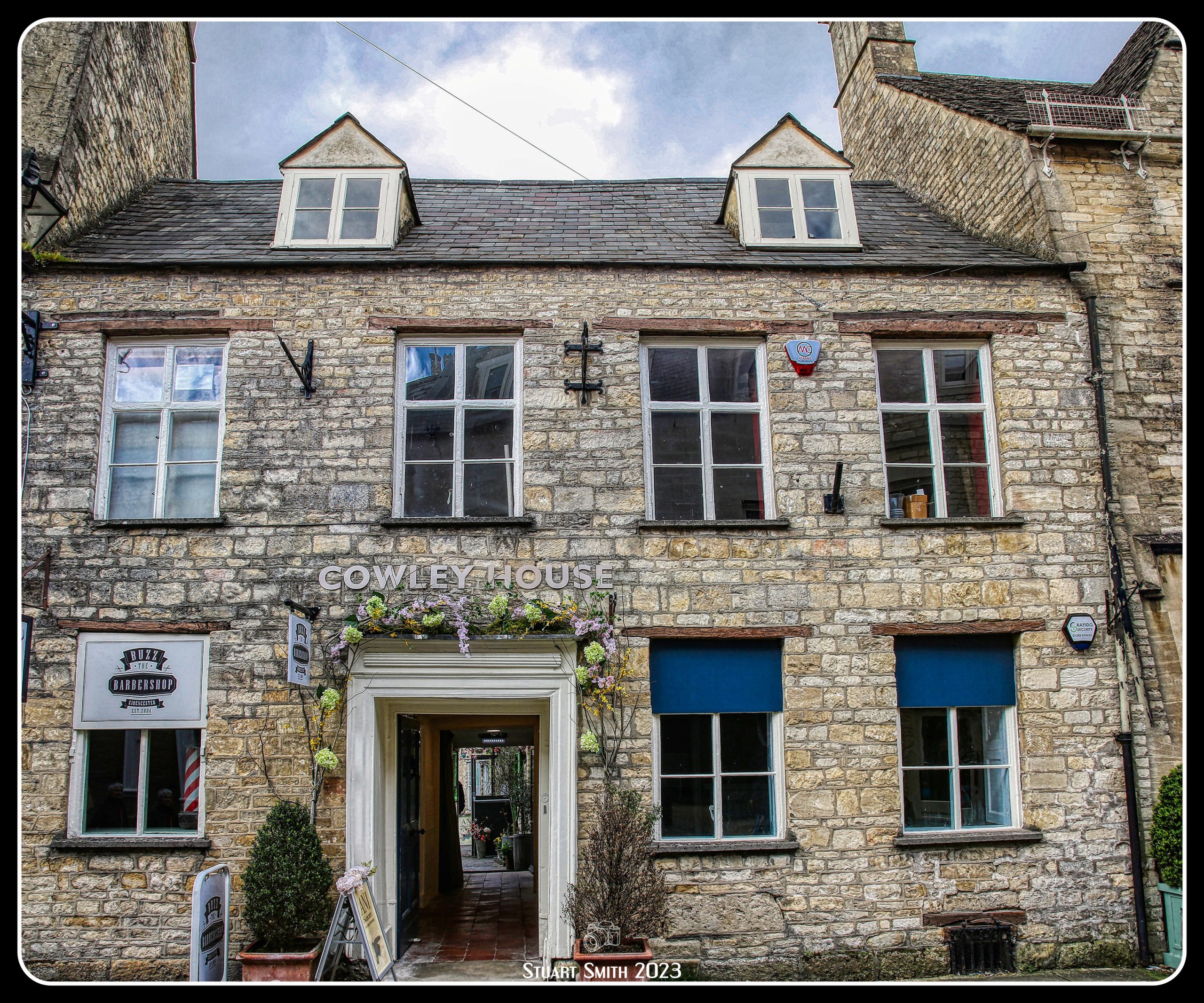
 Cowley House, 12 Black Jack Street, Cirencester, Gloucestershire, England UK
A Grade II Listed Building
 Door, 15 Black Jack Street, Cirencester, Gloucestershire, England UK
 12 Park Street, Cirencester, Gloucestershire, England UK
 View Along Silver Street, Cirencester, Gloucestershire, England UK
 Bathurst Estate, Park Lane, Cirencester, Gloucestershire, England UK
The Bathurst family originate from Sussex where, in the 13th Century, they owned extensive lands and a castle. The castle was subsequently demolished, but the name lives on in Bathurst Wood, where its ruins can still be discovered.
In 1695, Sir Benjamin Bathurst, a kindly and generous gentleman, purchased the current estate, known then as Oakley Grove. It was a gift for his eldest son, Allen, who became the 1st Earl Bathurst.
It was under his care that Cirencester Park became one of the greatest privately-owned parks of the 18th century and the finest forest landscape in England. It is still amongst the most beautiful in the country today. Having remained in the same family, its main advantage has been continuity.
Since the 1st Earl’s time the Bathurst Estate has been carefully stewarded by many generations. Following the 8th Earl’s death in October 2011, his eldest son Allen succeeded to the title. He presently runs and oversees the estate for future generations, supported by The Countess Bathurst.
The Park sits within the town of Cirencester, screened from it by the tallest yew hedge in the world. This remarkable feature has been much recorded in local and international history, especially when it comes to its annual trim – a job that takes two men two weeks to complete. Clippings have been used to further the research of the use of ‘taxol’ to treat cancer.
See beyond the wall:-
 “Dunstall House”, 27 Park Street, Cirencester, Gloucestershire, England UK
17th century, re-fronted in 18th century. Mishearing a suggestion by Earl Bathurst in the 1920s, that the house should be called after the Gumstool Brook which flows at the rear, a tenant called it Dunstall House, which has endured.
 8-16 Park Lane, Cirencester, Gloucestershire, England UK
Grade II Listed Building,which is 5 houses built in the early 1800s
 The Old Grammar School Forecourt Wall & Gate, Park Lane, Cirencester, Gloucestershire, England UK
Former Grammar School, now house. Late mediaeval, 1534-60, 1640s and 1760s with C20 alterations and repairs.
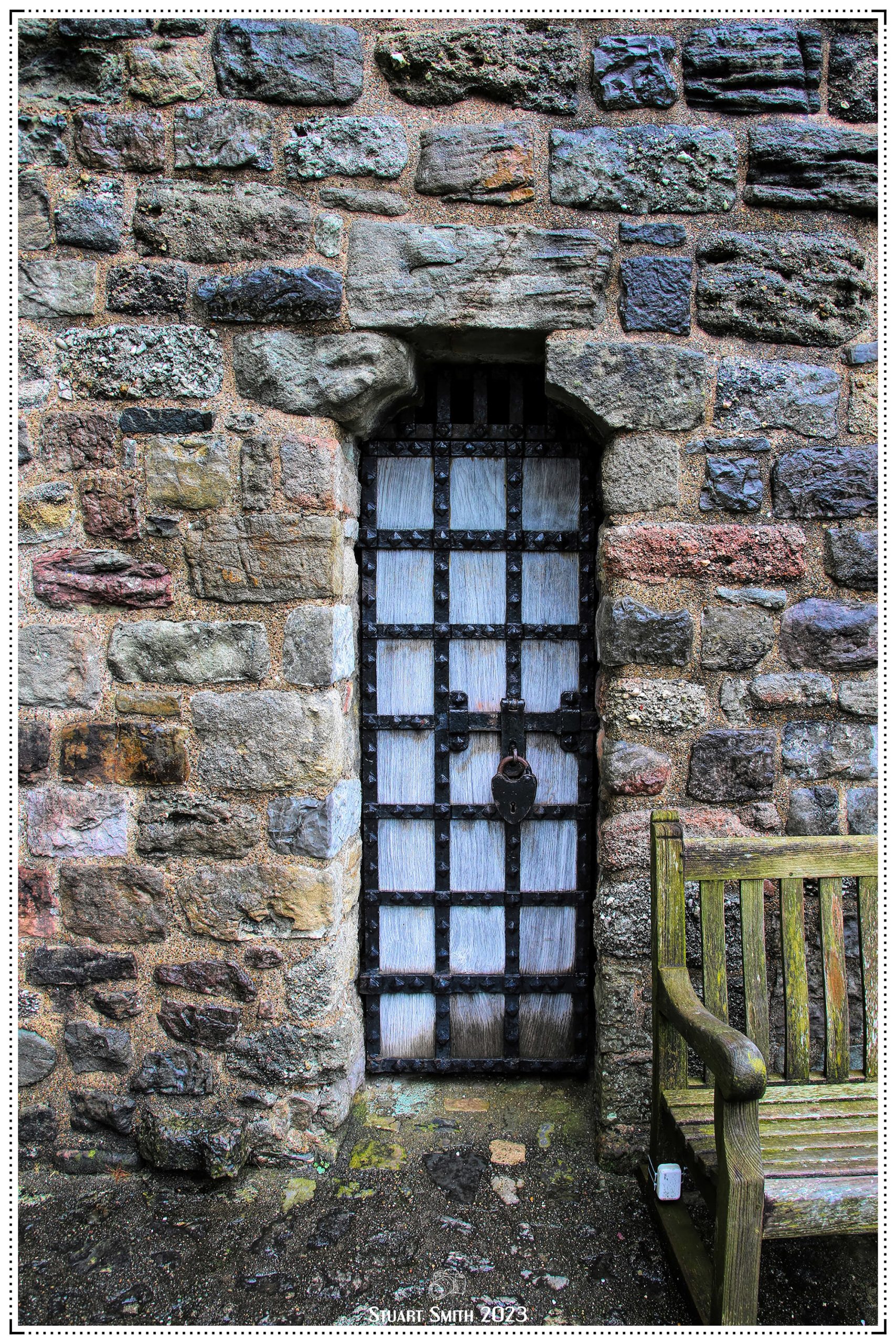
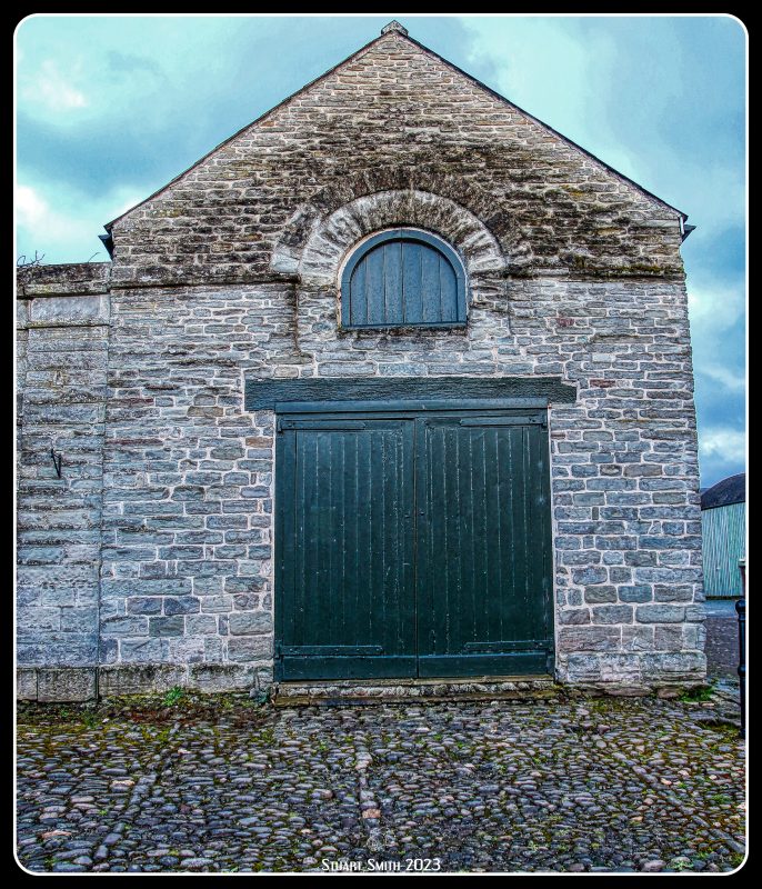
 Rear Yard Entrance, Old Police Station & Courts, 2 Park Lane, Cirencester, Gloucestershire, England UK
 The Old Museum, Tetbury Road, Cirencester. Gloucestershire, England UK
Henry George, the 4th Earl Bathurst (1790-1866), funded the building of Cirencester’s first museum in Tetbury Road. It was built to house the Hunting Dogs and Four Seasons Mosaics found in 1849 in Dyer Street, Cirencester, now on display in the Corinium Museum.
The museum opened in 1856 and received 1740 visitors in the first year. It was staffed by honorary curators and a resident custodian lived in the adjacent lodge. The Earl’s museum soon began to benefit from donations from other local collectors. By the 1930’s, when the Bathurst collection was given to the town, it numbered nearly 3000 objects.
 Street Sign, Sheep Street, Cirencester, Gloucestershire, England UK
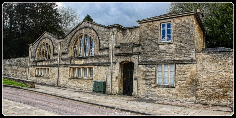
 Old Town Station, Sheep Street, Cirencester, Gloucestershire, England UK
That’s it for The Cotswolds and Cirencester. We then travelled to Hay-on-Wye in Wales where we once spent a week back in 2016. We even stayed at the same place and in the same room as back then.


 The Butter Market, Market Street, Hay-On-Wye, Powys, Wales UK
Hay Butter Market was erected by a local entrepreneur by the name of William Enoch in 1830. It replaced a very old open market in order to provide a covered market area for the use of local traders and farmers on market days which have always been a Thursday. It is situated right in the centre of town by Hay Castle Square.
The building had been walled up since just after the second World War but was opened up and restored by Hay Warren Trustees in 1985.
The Trustees won a “Prince of Wales Award” for this restoration. It is now used again every Thursday and also by other traders and charity organisations on most Saturdays and holiday weekends.
It is a Grade II Listed Building.
 A Wet Street, High Town, Hay-On-Wye, Powys, Wales UK
The Butter Market is on the left.

 Clock Tower, Jcn Lion & Broad Streets, Hay-On-Wye, Powys, Wales UK
Built 1884 by J C Haddon of Hereford. It originated in a legacy by Captain Brown for a clock for the church tower. This idea was expanded by the executors to include the town clock, public hall and corn exchange but only the former was built; cost £600.
It is a Grade II Listed Building
 The Rose & Crown (Centre) & The Old Electric Shop, Broad Street, Hay-On-Wye, Powys, Wales UK
The Rose & Crown is a 17th century building.
It is a Grade II Listed Building
 “Rest For The Tired”, Laneway off Broad Street, Hay-On-Wye, Powys, Wales UK
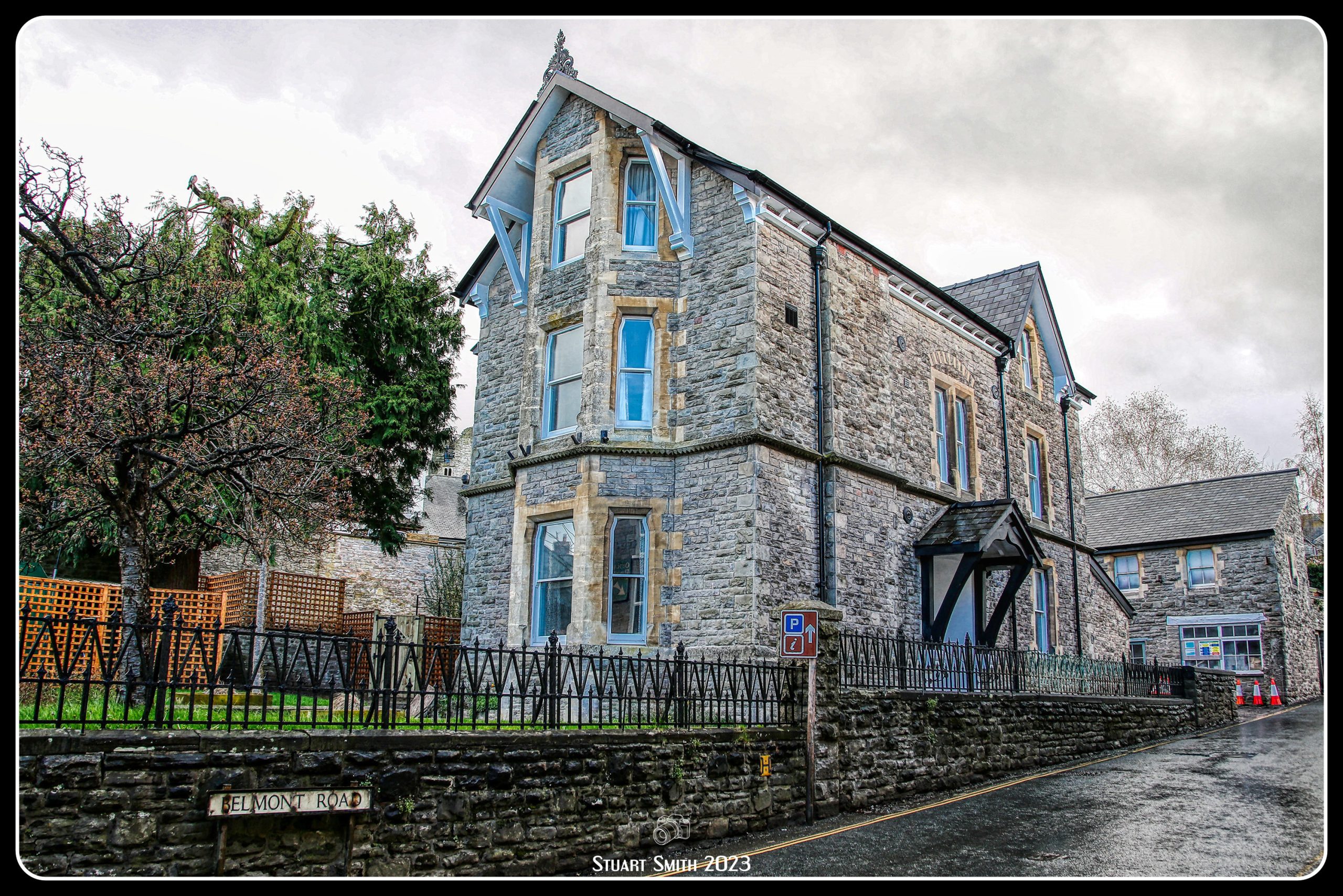
 Heritage Residence, Jcn Broad Street & Belmont Road, Hay-On-Wye, Powys, Wales UK
 St Joseph’s Church, Belmont Road, Hay-On-Wye, Powys, Wales UK
 Property Entrance, Belmont Road, Hay-On-Wye, Powys, Wales UK
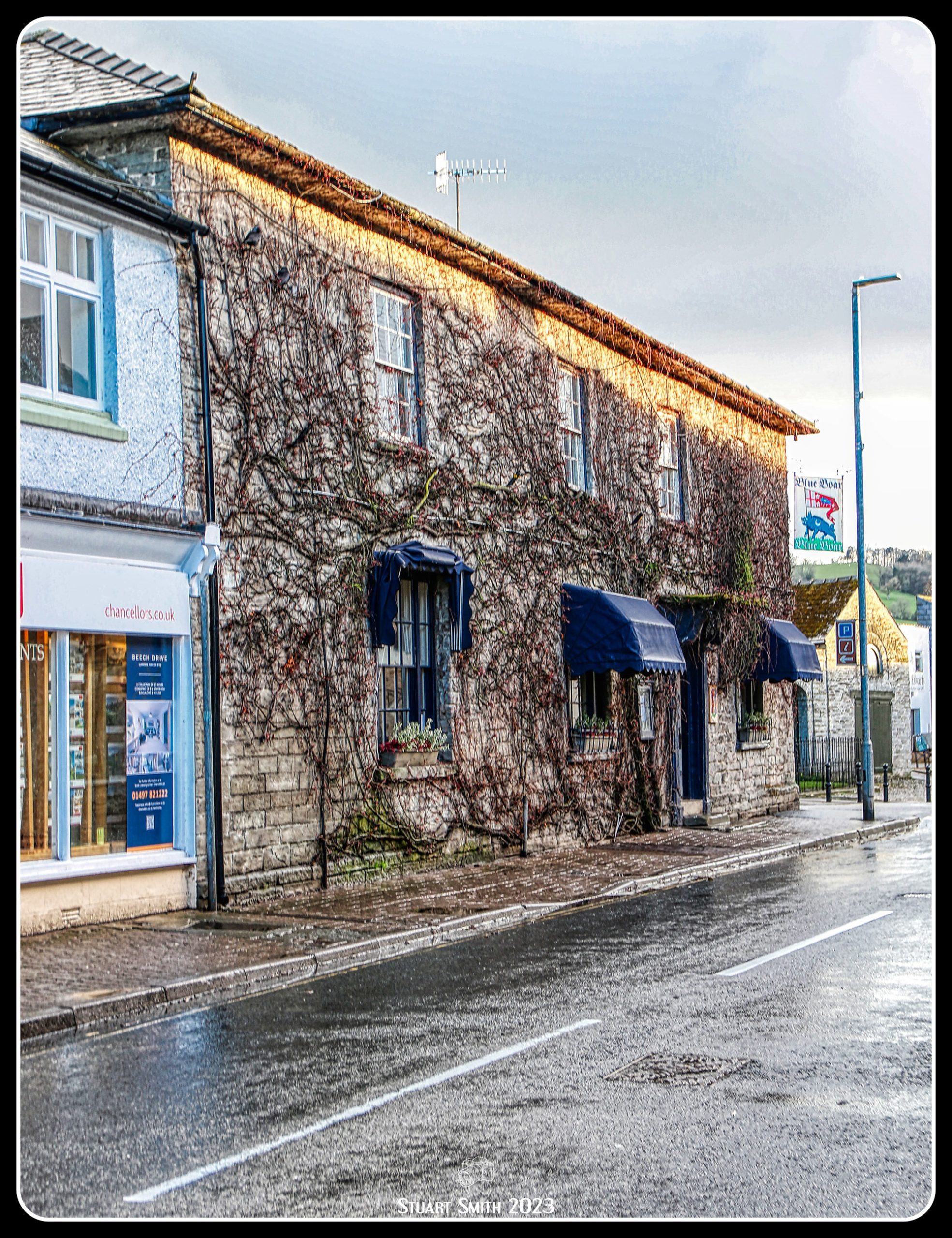
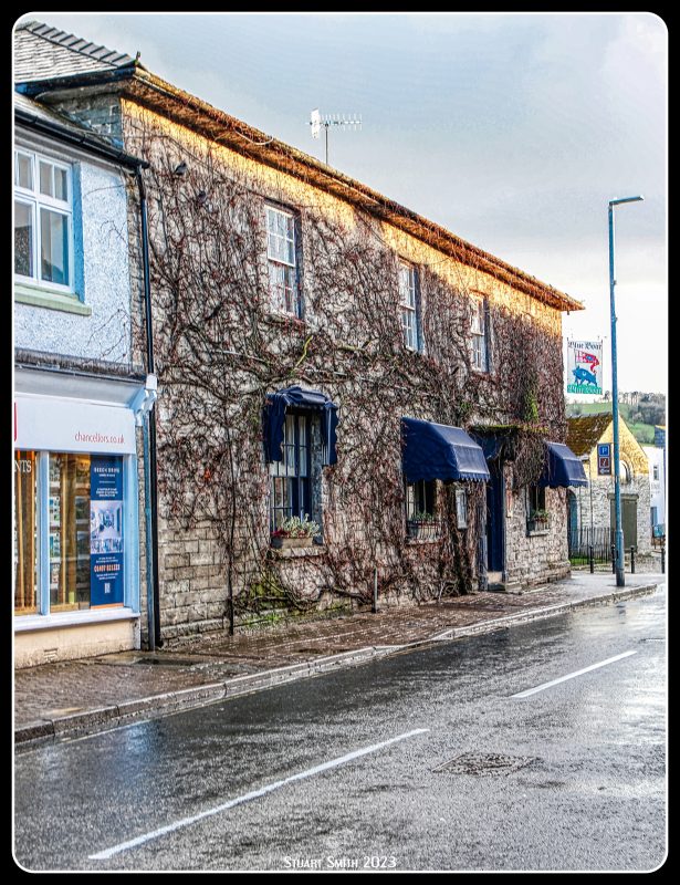 The Blue Boar, Castle Street, Hay-On-Wye, Powys, Wales UK
We had dinner here as we did back in 2016.
Late Georgian architecture (shown on 1847 Tithe map) with 17th century origins to rear.
A Grade II Listed Building
 “Radnor House”, Oxford Road, Hay-On-Wye, Powys, Wales UK
A Grade II Listed Building
 Heritage Residence and Adjoining Buildings, Church Street, Hay-On-Wye, Powys, Wales UK
 Building Attached to Heritage Residence, Church Street, Hay-On-Wye, Powys, Wales UK
 Oxford Road, Hay-On-Wye, Powys, Wales UK
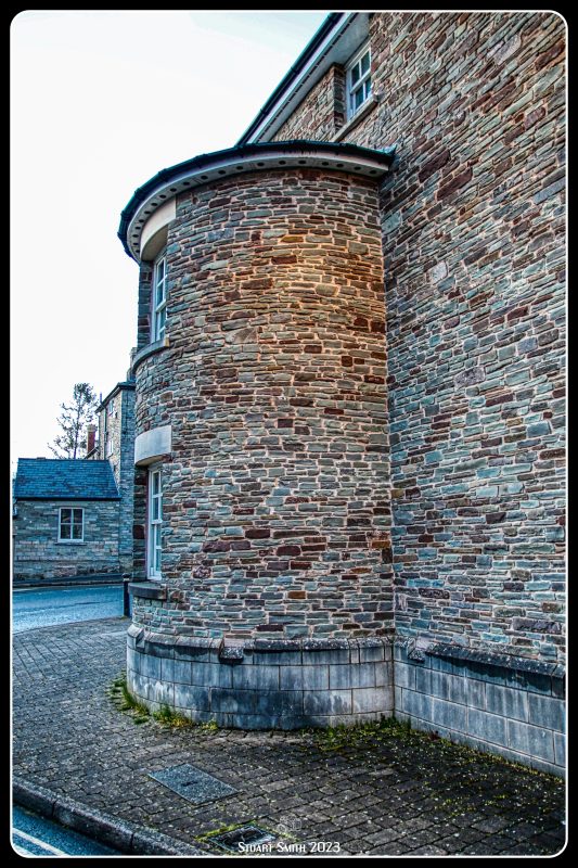 “Rounded”, Llys Brewys (Off Church Street), Hay=On-Wye, Powys, Wales UK
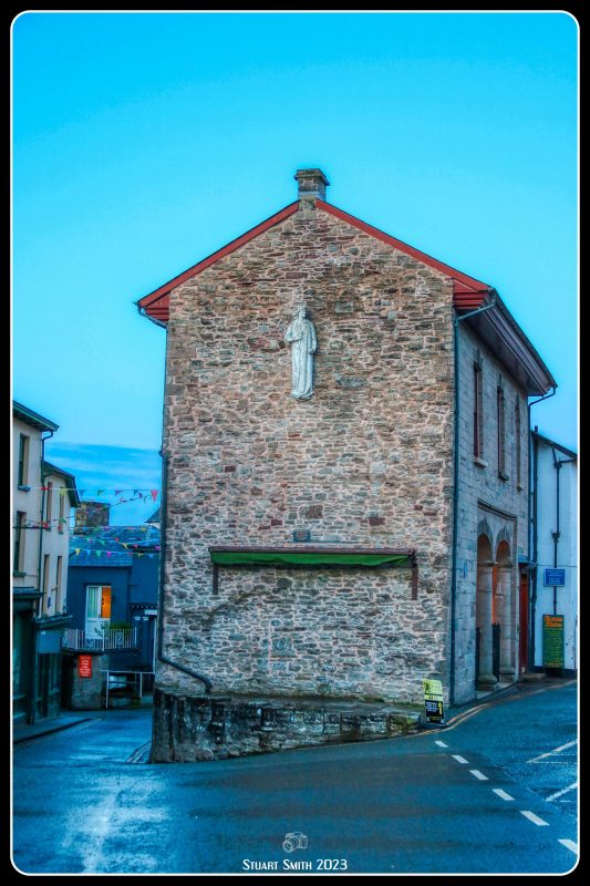 The Cheese Market, Market Street, Hay-On-Wye, Powys, Wales UK
The Cheese Market in Hay-on-Wye (Welsh: Marchnad gaws Y Gelli Gandryll), formerly Hay-on-Wye Town Hall, (Welsh: Neuadd y Dref Y Gelli Gandryll), is a municipal building in Market Street, Hay-on-Wye, Powys, Wales. The structure, which has been restored with support from the Heritage Lottery Fund so that the first floor can be let out for residential use, is a Grade II Listed Building. Built in 1835 and statue on the higher part of the wall is Henry VII.


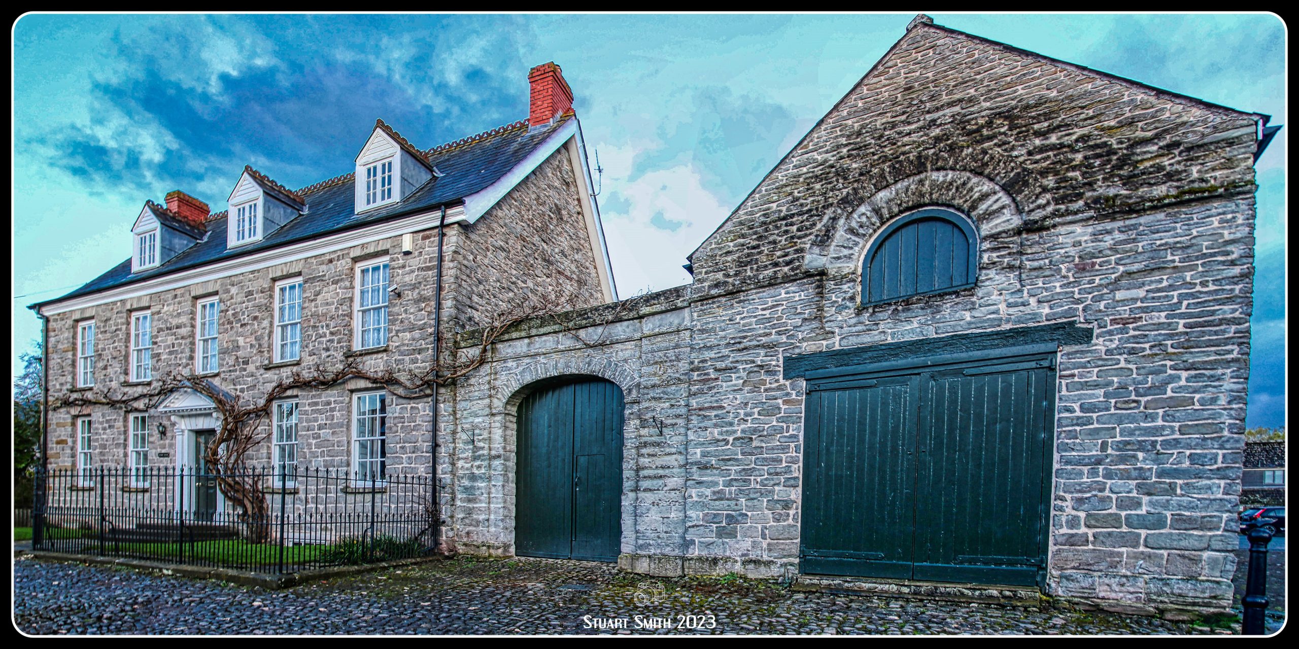
 Hay Castle, Castle Street, Hay-On-Wye, Powys, Wales UK
Probably built by Bernard de Newmarch and once surrounded by a moat. The castle is traditionally thought to have been rebuilt by Maude de St Valerie; was burnt by King John in 1216, rebuilt by Henry III in 1233, burnt by Prince Edward in 1263 and later suffered further damage under Owain Glyndwr. The double pile Castle House was begun by James Boyle ca 1660; divided up after 1702 and in 1844 sold to Sir Joseph Bailey. Major restoration by W D Caroe ca 1910; major fires in 1934 (E half) and 1977 (W half).
A Grade I Listed Building
 War Memorial, Jcn Castle Lane and Castle Street, Hay-On-Wye, Powys, Wales UK
The memorial was unveiled in the centre of the Market Square in 1920. After 1945 it was moved to an enclosure set into the boundary wall of the castle grounds, which allowed for additional plaques to be set up commemorating the dead of World War II.
It became a Grade II Listed Building in June 2020.


 Kilvert’s Country Hotel, Cnr Bull Ring & Bear Street, Hay-On-Wye, Powys, Wales UK
Grade II Listed Building described as a Late Georgian remodelling of a 17th century structure.
This was where we stayed in Hay-On-Wye.
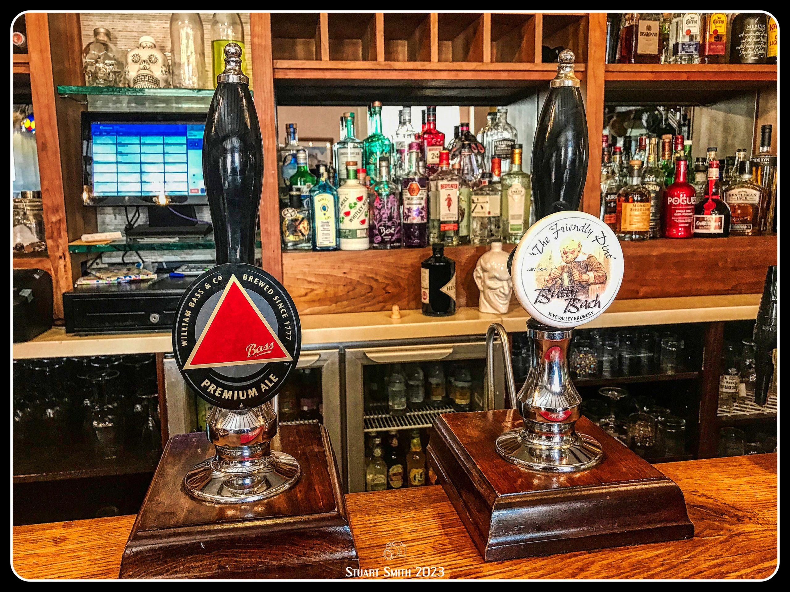
We stopped for lunch at this lovely country pub on our way from Hay-On-Wye.

 Dining, The Brigand’s Inn, Mallwyd, Machynlleth , Powys, Wales UK
This pub is also a Grade II Listed Building
 Just a Few Pints
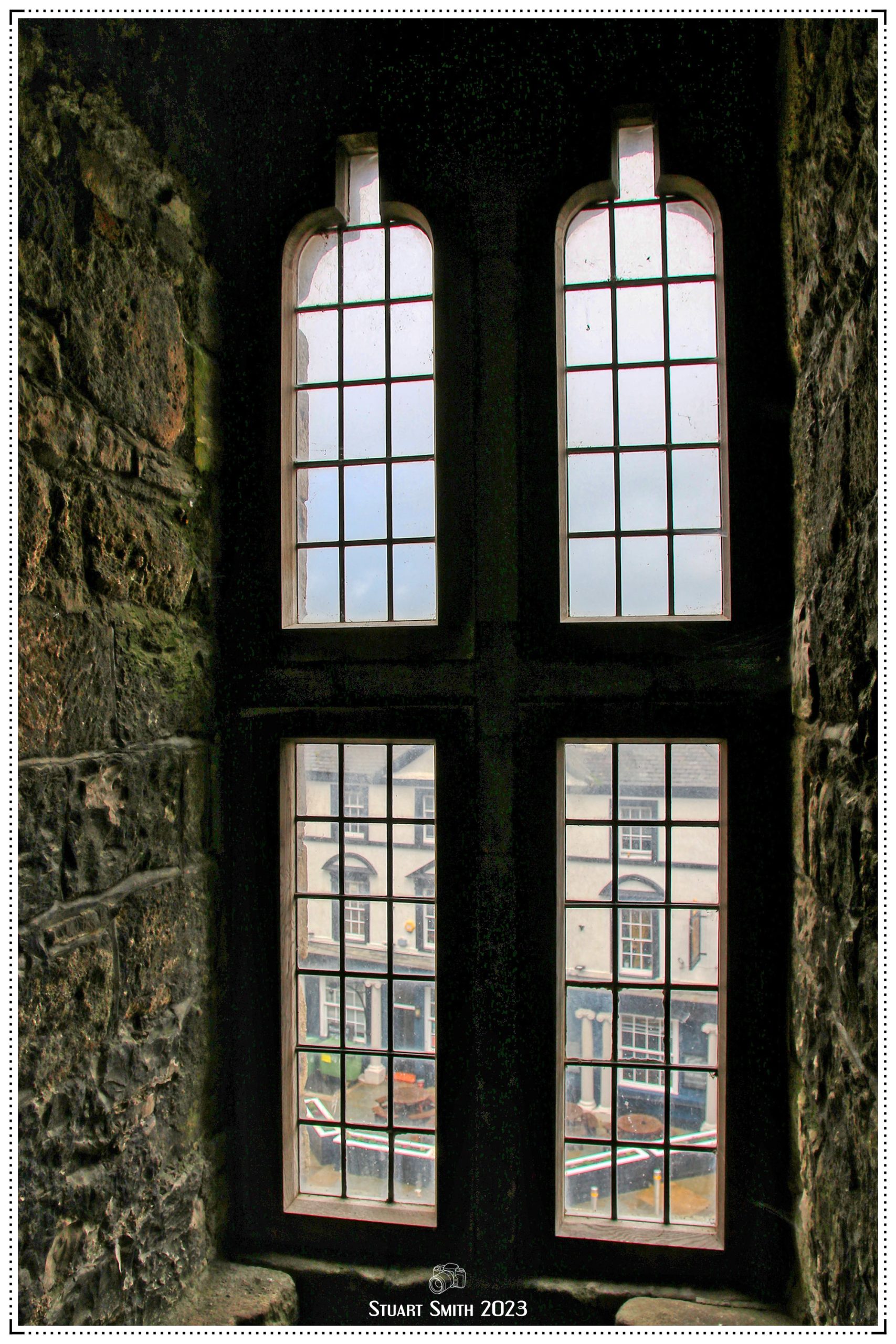
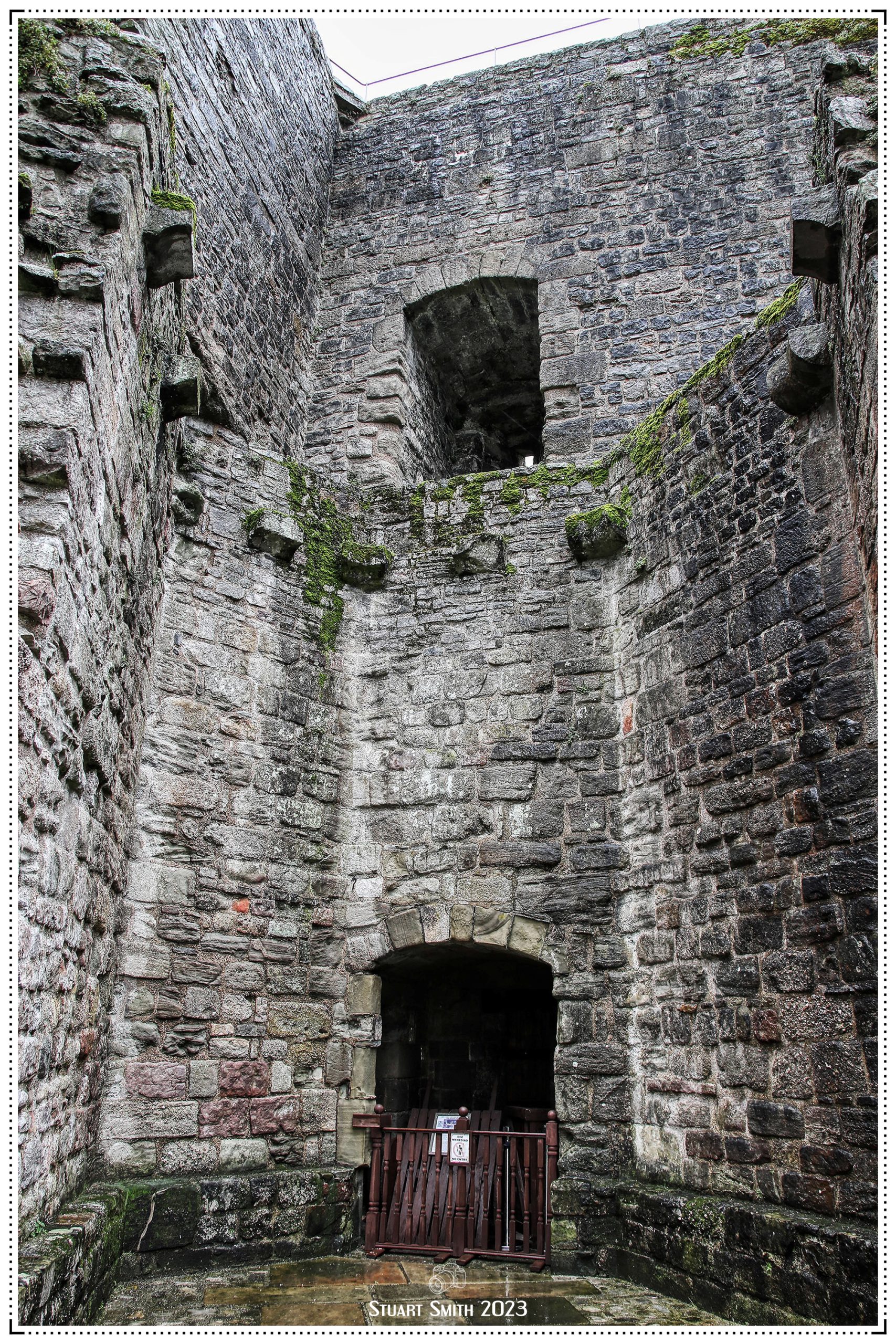
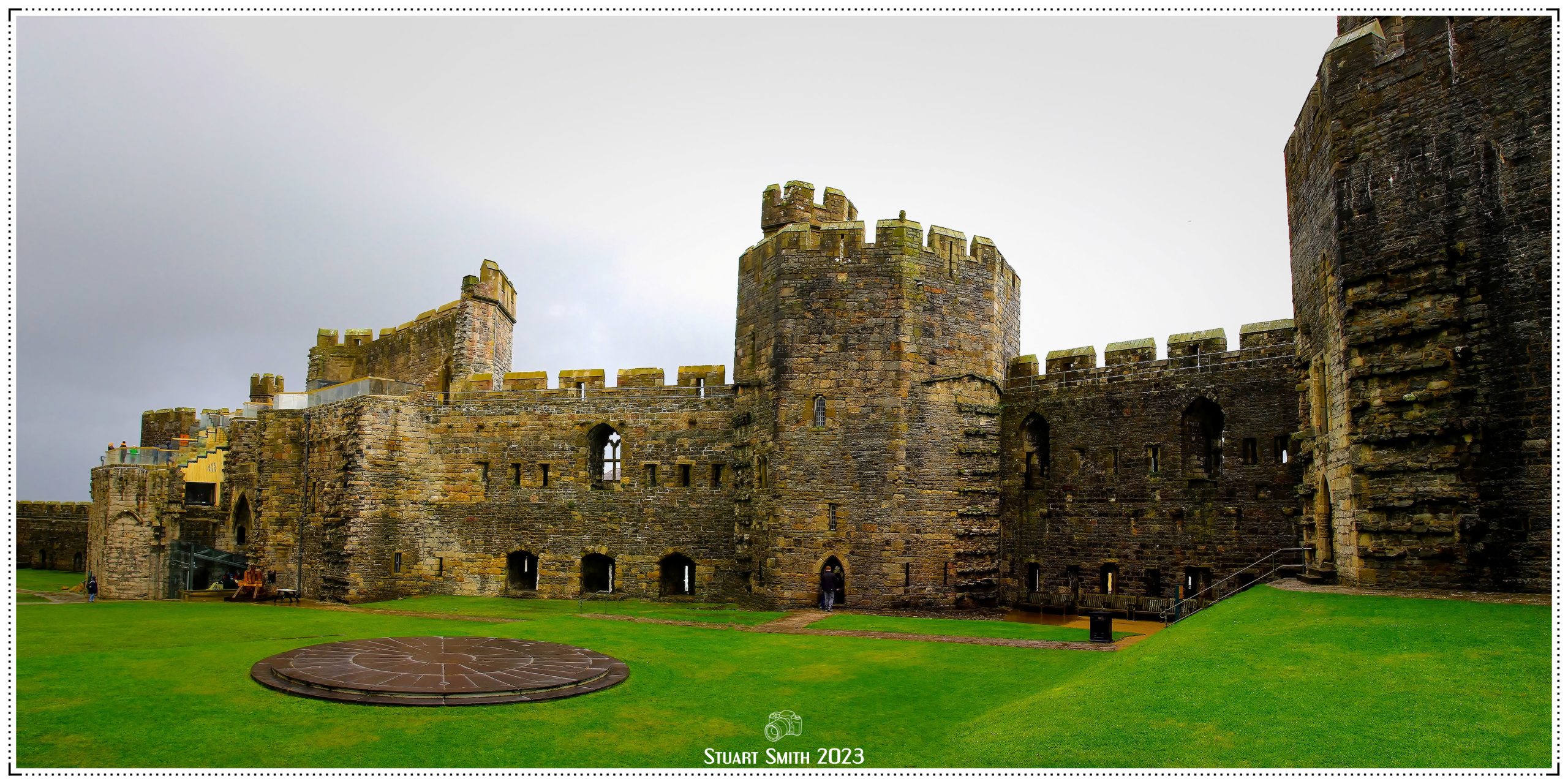
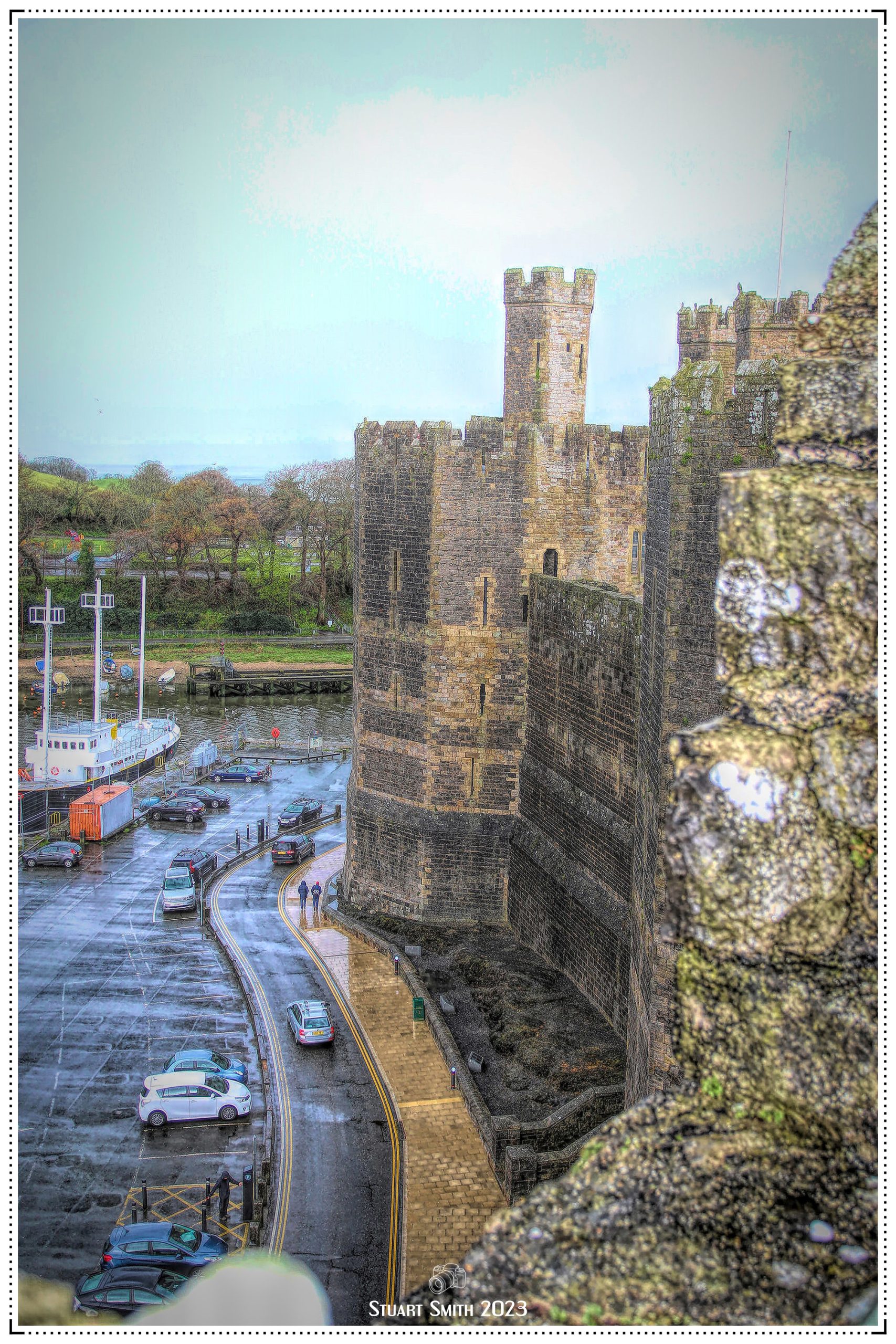
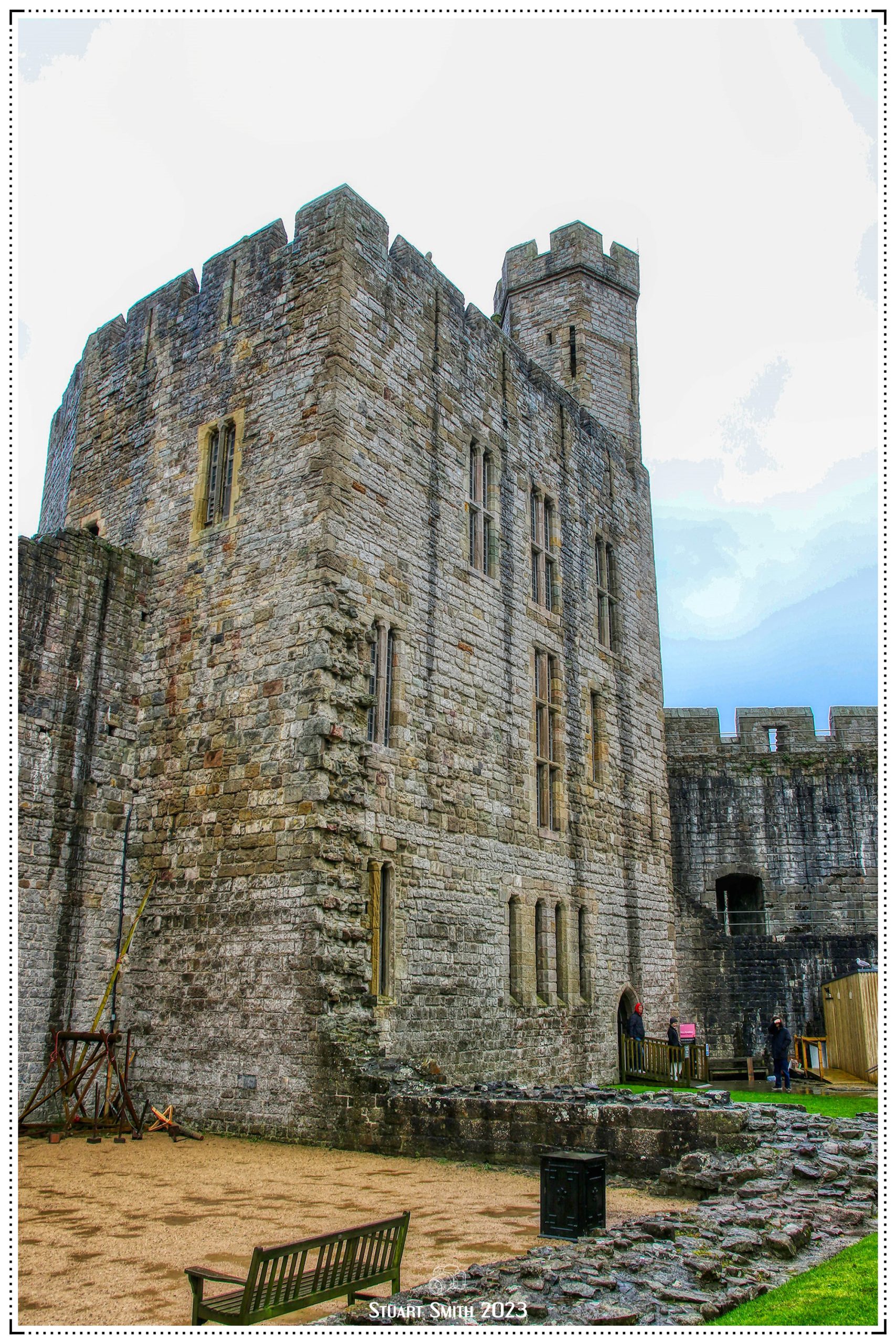
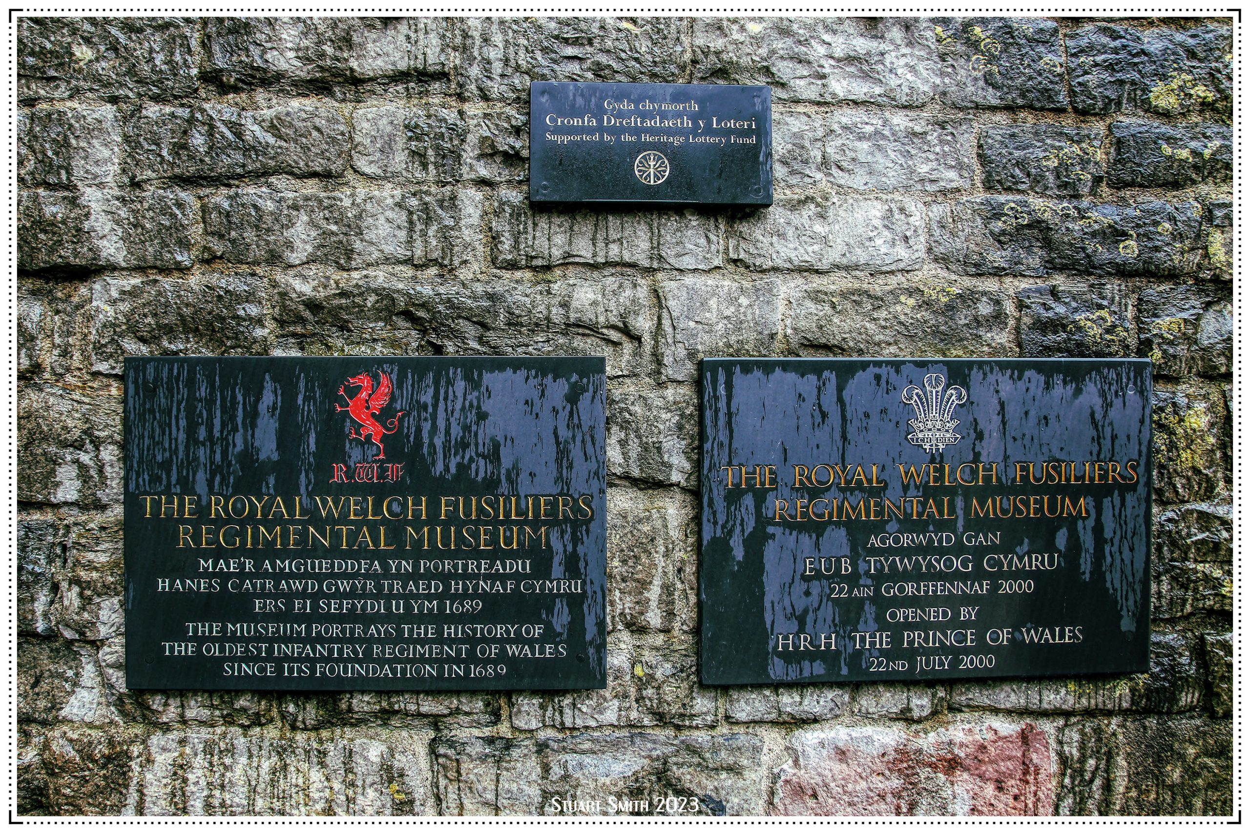
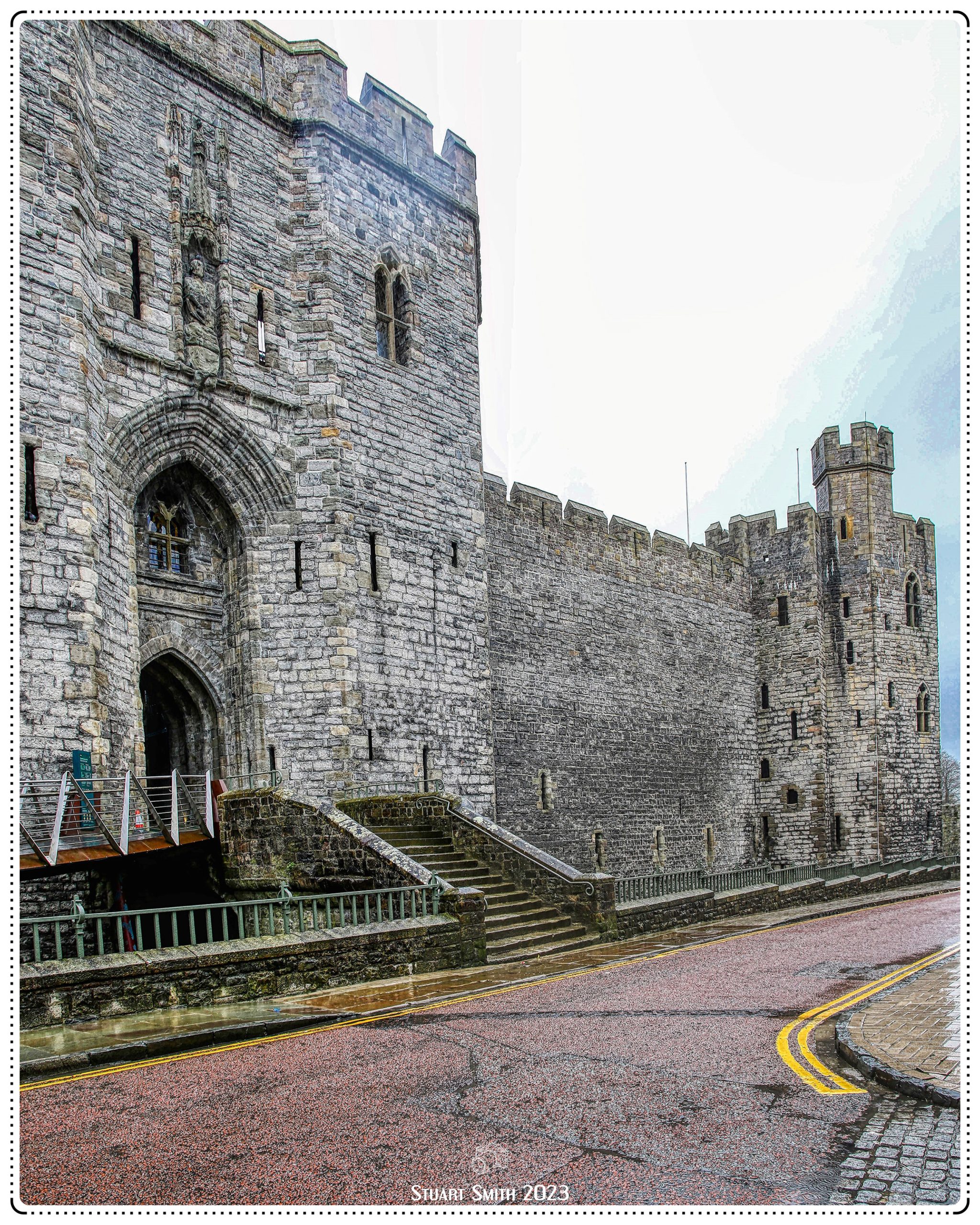
 Front Entrance, Caernarfon Castle, Castle Ditch, Caernarfon, Gwynedd, Wales UK